Right off the top, I'm not talking DWI here, its just a name of a route I have been exploring out here in southern Ontario.
There is a big lack of official 4WD trails here in the east, and particularly in the Great White North east. What I have come to realize however is that although this is true, one can make their own very interesting trails by doing some extensive exploring, particularly with the help of a good GPS unit and a set of very detailed topographic maps. Where it will differ however is that somewhere along the route, you will end up driving on pavement just to get to the next section. But that's just the realities of southern Ontario living. What you tend to look for are lines or sideroads marked "no maintenance beyond this point, use at your own risk", snowmobile trails, etc.
In any case, I had a fun outing that is not too far north of Toronto before mother nature decided to incapacitate my Trailblazer. The route is from Hockley to Creemore and I'm calling it The Beer Run because of the two microbreweries.
Note: Hockley Valley brewing has since moved to Orangeville, and Creemore Springs has been bought by one of the big two, but is keeping its microbrewery-style production. Oh well ...


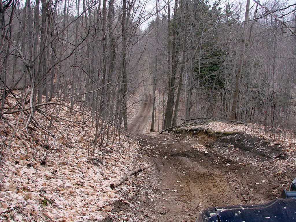
The time of year I went (early Spring) I would say its still a little too wet. A vehicle without good M+S tires and locker would have definitely got stuck in 2 or 3 places. I made it through. These weren't too bad, there were definitely worse places.
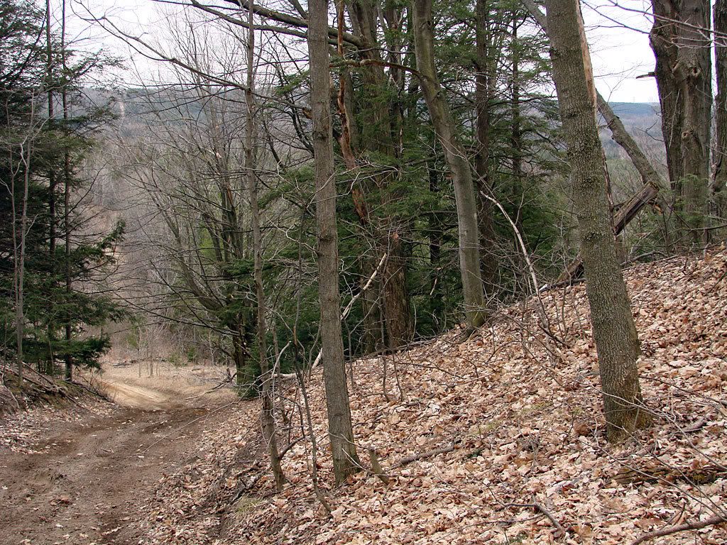
Even though there are no "mountains" around, Southern Ontario has its share of river valleys, plus the Niagara Escarpment. My route traverses both in an area called "The Hills of Headwaters".
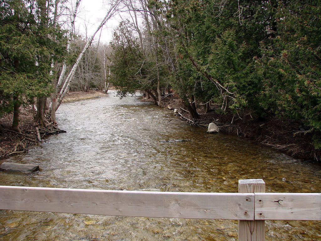
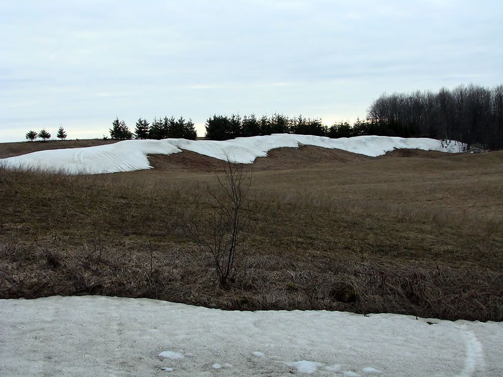
Spring runoff in one of the valleys and the last remnants of winter.
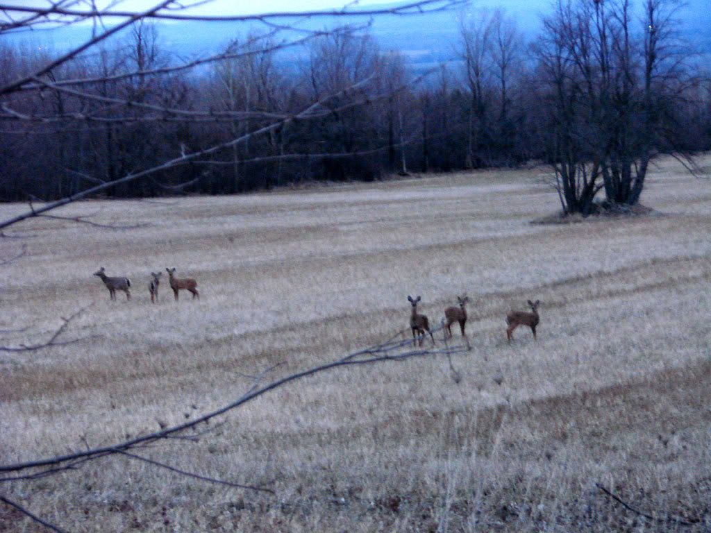
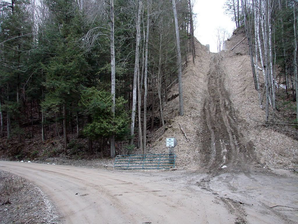
I'm not going up that hill without 4.56 gears! Luckily there is a bypass. The deer come out at dusk.
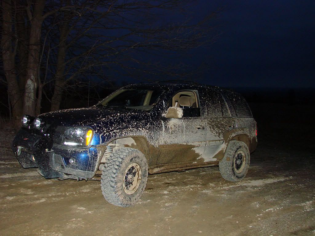
Nice view at dusk from the top of a hill. And this is what you get when you hit the trails too early in the Spring.
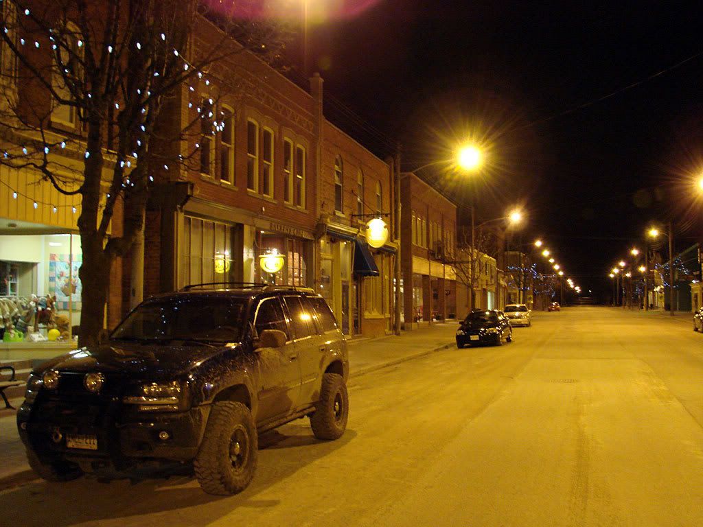
And finally at the destination (a little later than planned). The Creemore Springs Brewery. My muddy Trailblazer on a lonely street.
My GPS told me that the route is about 80 km. There are some really interesting areas, very easy sections, and some places I didn't even attempt by myself. The best time for this run would definitely be during the fall colour season, very spectacular.
Map References - Beer Run
View map in larger window.
This is the map of the start and ending points plus the paved route.
The offroad route is obviously more interesting but not finalized yet.


No comments:
Post a Comment