X88 expeditions - Documenting and sharing overland travels, adventures, and expeditions

November 16, 2009

Utah Expedition - Days 17 & 18 - Sep 20, 21

Map References - Day 17 - Sep 20

September 20 track:

* large files - 1800 x 1200

View Sep 20 track in larger window.
Overall it was a great trip for me. The vehicle held up very well again. The only regret I have is that I did not camp anywhere. I'm not sure why I didn't on this trip. I had everything I needed with me but for some reason there just seemed to be a lack of conviction on my part. Maybe it has something to do with the Tent Cot I use for camping. Its very quick to set up and tear down outside the vehicle. However, it does take some doing to take it out and put it back as I have to remove a lot of things that sit on top of it while traveling. Plus getting access to the camping gear I have in the ammo cases on the roof rackis somewhat clumsy with how I have them tied down.

There will definitely be some upgrades in my near future, particularly if I want to go for another extended adventure next year. I see drawers; I see a different, smaller footprint fast deployment tent; I see better tie down techniques for items on the Safari Rack; I see more planning needed!

Well, until next time!

The next two days were long drives again and luckily, with great weather. There must be a better way to get out west with your vehicle!

I didn't take many photos, except of other Trailblazer/Envoy vehicles that passed me (see first post). Here are a few curiosities from the road, they are self explanatory.

Map References - Day 18 - Sep 21

September 21 track:

* large files - 1800 x 1200

View Sep 21 track in larger window.

Utah Expedition - Day 16 - Sep 19

Map References - Day 16 - Sep 19

September 19 track:

* large files - 1800 x 1200

View Sep 19 track in larger window.
Once on I40 it was pretty much a straight drive through Amarillo, TX, then around Oklahoma City, OK, and finally into a suburb of Tulsa.
The weather held up nicely and although quite long, the drive ended up being OK. Having XM Radio is really a lifesaver on these long drives. Not only does it give me access to the channels I really like from anywhere, but when combined with this product:
This day was going to be a very long drive across mostly flatland. I started out heading south from Espanola, NM and around the other portion of the Santa Fe National Forest. The road actually took me right through Santa Fe.
from USA Spec, it lets me play everything I have on my iPod, including being able to use the steering wheel controls!

November 14, 2009

Utah Expedition - Day 15 - Sep 18 - Part 2

Map References - Day 15 - Sep 18

September 18 track:

Comb Ridge & Valley of the Gods:

* large files - 1800 x 1200

View Sep 18 track in larger window.
The trail winds its way through and around the impressive rock formations with short side trails that lead to what look like spectacular backcountry campsites at the base of the buttes along the ridge. Towards the end I stopped at a grand overlook whith an impressive view of the entire valley.
The 500mm lens captured a close up of the 2 spires that the road passes between - see the middle picture at the top. From the same overlook, I noticed some interesting formations way in the distance to the south so I tried to capture those as well. They are in fact part of Monument Valley.
After descending the Moki Dugway, I turned onto the western end of the Valley of the Gods Trail (Southeast #43, page 195). This is also an easy 2 rated graded dirt road but I happened to be there at a great time of day which brought out the amazing colors of the various buttes and rock formations with imaginative names like Setting Hen, Rooster Butte, Rudolph and Santa Claus.
I decided then that I would make time to head a bit more south than I originally planned to pass through Monument Valley, although I didn't have time to stop by the visitor center and drive the 17 mile loop road. I did get some nice shots from the Trailblazer as I was approaching.
As an aside, while I was working on this post an image kept popping into my head of a very thin spire in the middle of nowhere with Clint Eastwood climbing it. I realized that this was from the movie "The Eiger Sanction" where his character is training for a climb of the Eiger in Switzerland, noted for its dangerous climb. The spire is in fact in Monument Valley and is called The Totem Pole. What does all this have to do with my trip and overlanding?

Well nothing directly except that through some side research and linking, I came across a still from the movie that shows the vehicle Clint Eastwood's character was driving in the area, which led me to this site:
http://imcdb.org/

The Internet Cars Movie Database. So if anyone wants to know for example:

Its all in the database. Sometimes the Internet still amazes me!

OK, back to the trip. As the sun was setting I was driving east through Arizona and then onto New Mexico.

As was the case earlier with Yellowstone and Grand Teton, some very worthwhile areas would unfortunately have to be missed on this trip. Places like Canyon de Chelly National Monument in Arizona and Santa Fe National Forest in New Mexico which I passed through in the dark on my way to Espanola.

Utah Expedition - Day 15 - Sep 18 - Part 1

This day started with absolute clear skies, the ominous weather from the night before seemed to just disappear. As I leave the hotel and out to the Trailblazer I see this sitting in the parking This was a melancholy day for me as it was time to start to head back home. Originally I planned 4 days for the trips out and back so that I could stop here and there at interesting places instead of just tearing along the Interstates. However, Utah has so much to offer that I decided to reserve half the day for one final set of local exploration and the other half would be the beginning of my drive back east.

So early that morning I got out the Massey/Wilson Utah book and worked out a route that would start close to Blanding and make its way south and then east. To maximize my time the trails needed to not be return trails (i.e. ones with a dead end).

Comb Ridge was close by so I started at the north end of Comb Wash Trail (Southeast #46, page 202 of the book), it's rated difficulty 2 and scenic 9. Comb Ridge is a monocline which is a type of ground upheaval.

The first picture is of the cut made for the highway that allows for travel across the ridge. The book provides a historical perspective:
To the 1880 Mormon Hole-in-the-Rock Expedition, Comb Ridge appeared an impassable barrier as they descended from Cedar Mesa. They were forced to swing south and eventually succeeded in crossing Comb Ridge at San Juan Hill near where the San Juan River cuts through the ridge.

The trail follows parallel to the ridge on the west side and crosses through Comb Wash several times. Recent rains left many of the crossing wet and muddy although with good momentum, I did not have any issues.

Almost at the end of Comb Wash Trail, there is a turn-off for Snow Flat Road (Southeast #45, page 199 of the book). Snow Flat Road is described as a little more difficult rating a 3 due to a section of exposed rock with climbs and drops called "The Twist". After making a right turn, the road starts heading back north but fairly quickly heads east.

At about the halfway point, the trail heads up through the rocks. Its easy to follow but definitely slow going as there are many areas where wheel placement is key.
The drive west on Cedar Mesa was a smooth one as there were not many areas of washboarding. There was one short area of exposed rock to traverse and then close to the highway a long, fairly deep, and muddy stretch that ultimately posed no problem.

As I headed south on State Route 261, I basically ran out of plateau. The highway turns into a wide graded gravel road and descends the cliffs, known as the Moki Dugway. I tried to snap a few photos heading down but could not stop as these switchbacks are trafficked quite a bit since the road has been made wide enough for 2 way traffic including campers and RVs.

The last picture shows an area where it is quite narrow, definitely room for only 1 vehicle. As I headed in, I met up with a motorcycle coming the other way. We exchanged greetings and he indicated that he was scouting ahead for his wife and their pickup. He then headed back and I followed. A little while later I passed by their pickup and told them they should not have any problems as long as they take is slow and are careful with wheel placement.

After clearing "The Twist" you end up on a plateau called Cedar Mesa. I should note that this whole area is rich in Native American ruins, Petroglyphs, and Pictographs but unfortunately I could not explore on this day as I still had one more area I wanted to get to plus the drive starting back home.

November 10, 2009

Utah Expedition - Day 14 - Sep 17 - Part 2

Map References - Day 14 - Sep 17

View Sep 17 track in larger window.
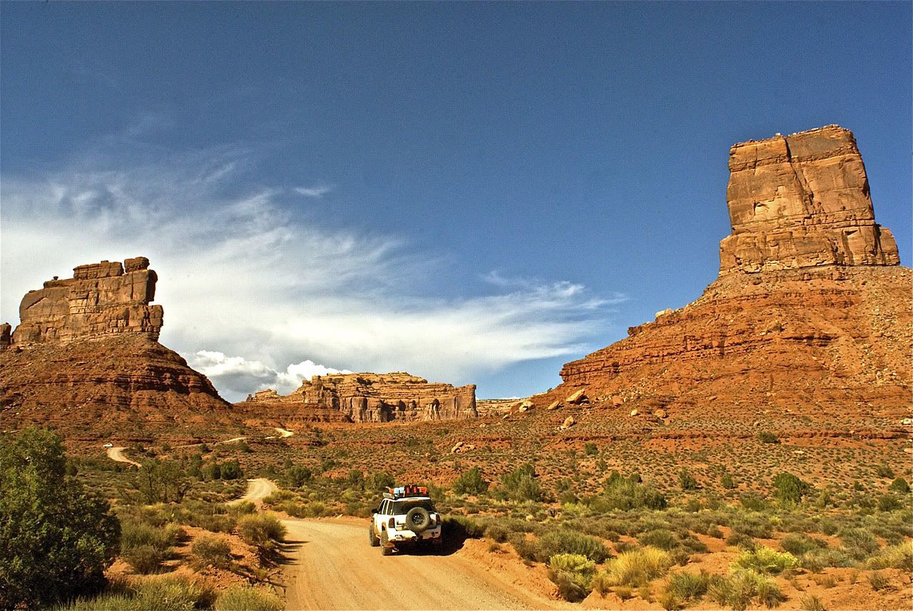
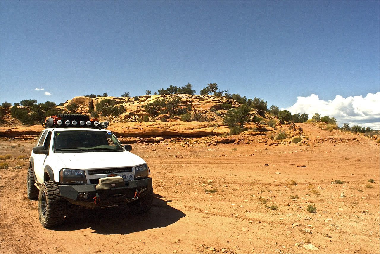
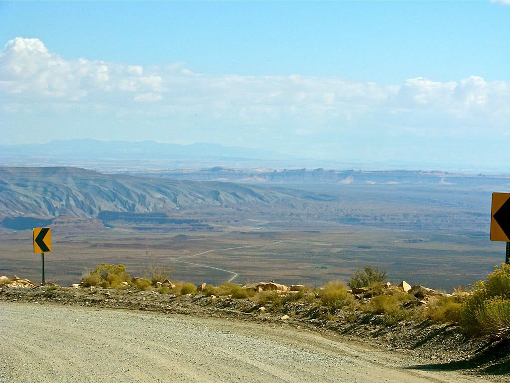
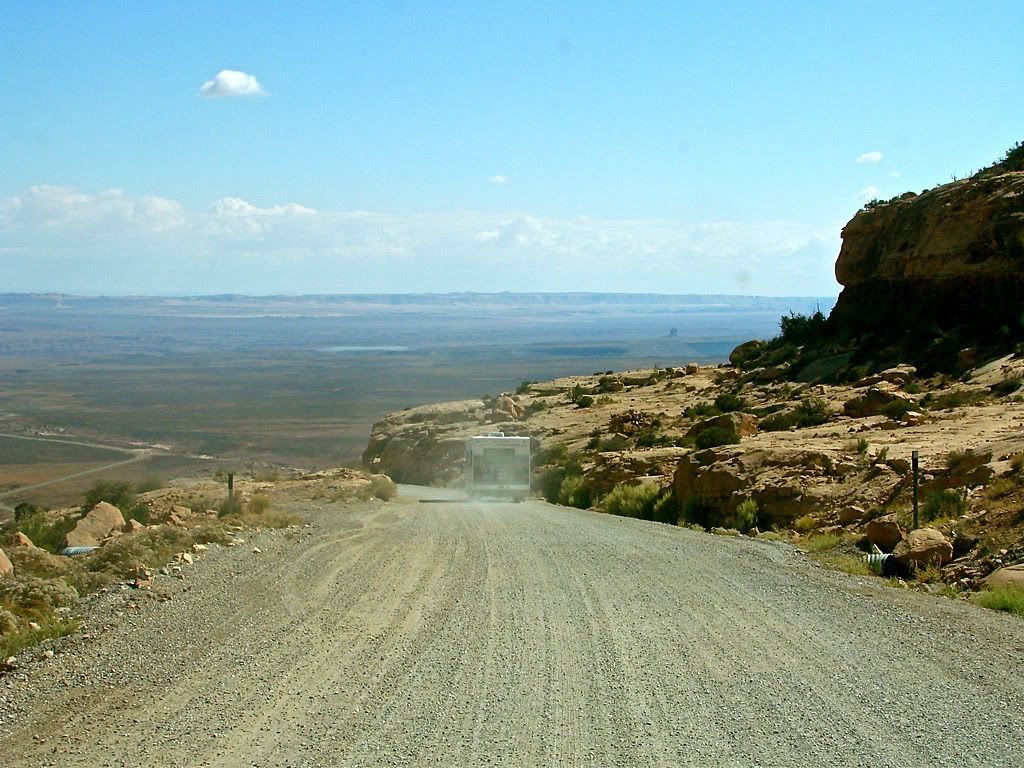
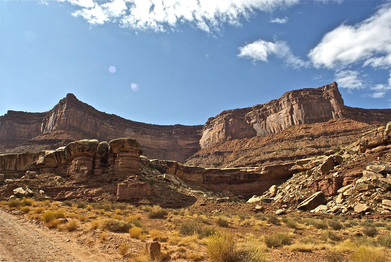
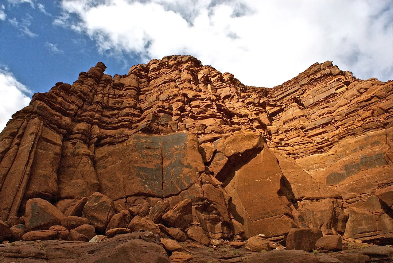
Once at the bottom, the trail widened and became mostly a graded dirt road. There were some wash crossings which combined with the steep, narrow descent rates the trail a 3 in the Utah book, with a scenic rating of 10 of course. The washes were quite a bit drier than over at Reds Canyon trail so this area must not have experienced that much rain lately. The first picture below shows the Shafer Trail overlook, its that outcropping with the little point at the top. The Google terrain map indicates a vertical drop of about 1400 feet.
Very close by was the turn off for the White Rim Trail. The Utah book shows the trail as 68.4 miles and strongly suggests a 2 day drive with camping. Particularly if one were to explore some interesting spur trails like Lathrop Trail which takes you right down to the Colorado river, and Taylor Canyon Trail which takes you to Moses and Zeus rocks.

I was considering reserving a camping site (reservations are mandatory) and doing the entire White Rim but in the end, time was against me and I'm not sure if I would be comfortable tackling this trail by myself with my current set up. But it gives me a beautiful excuse to come back and give it a try!

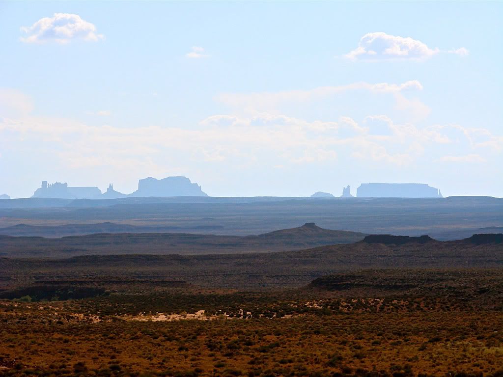
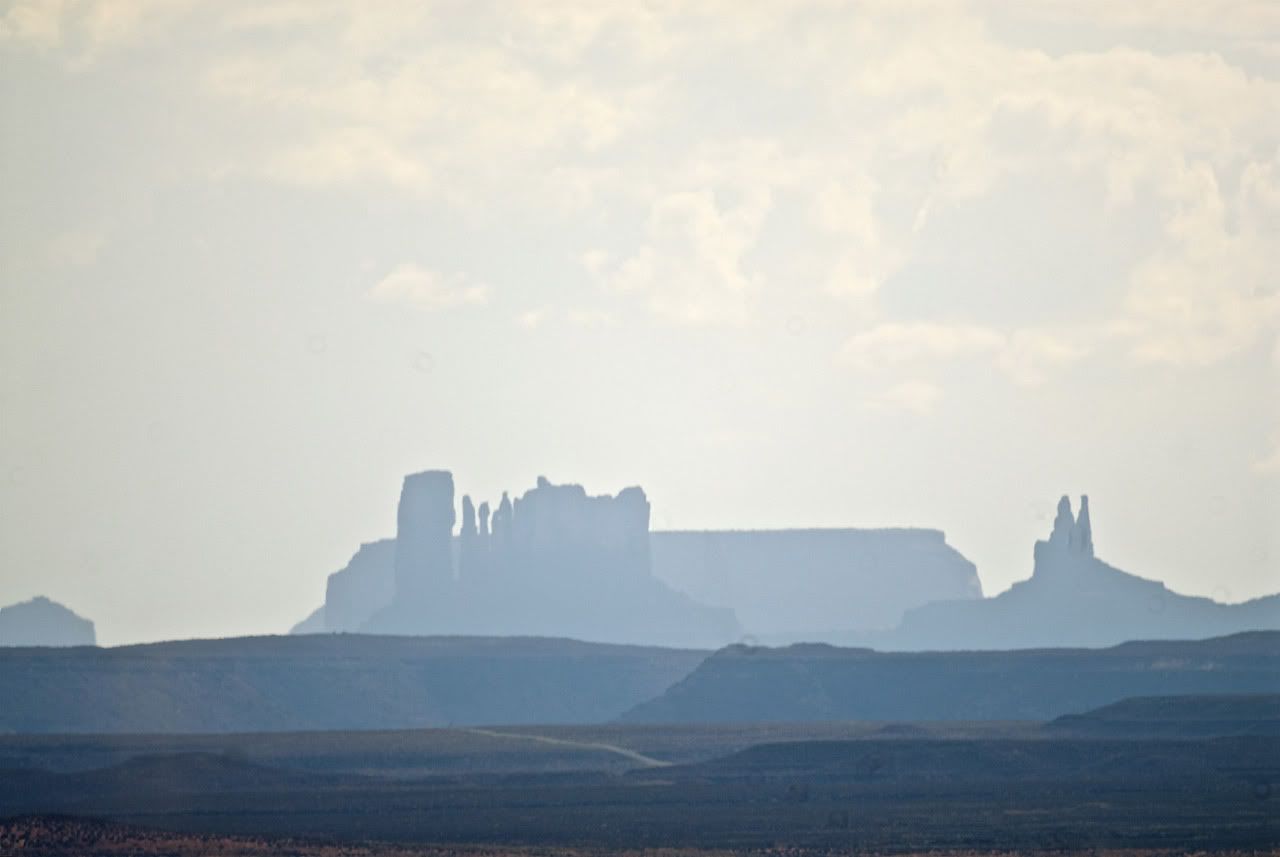
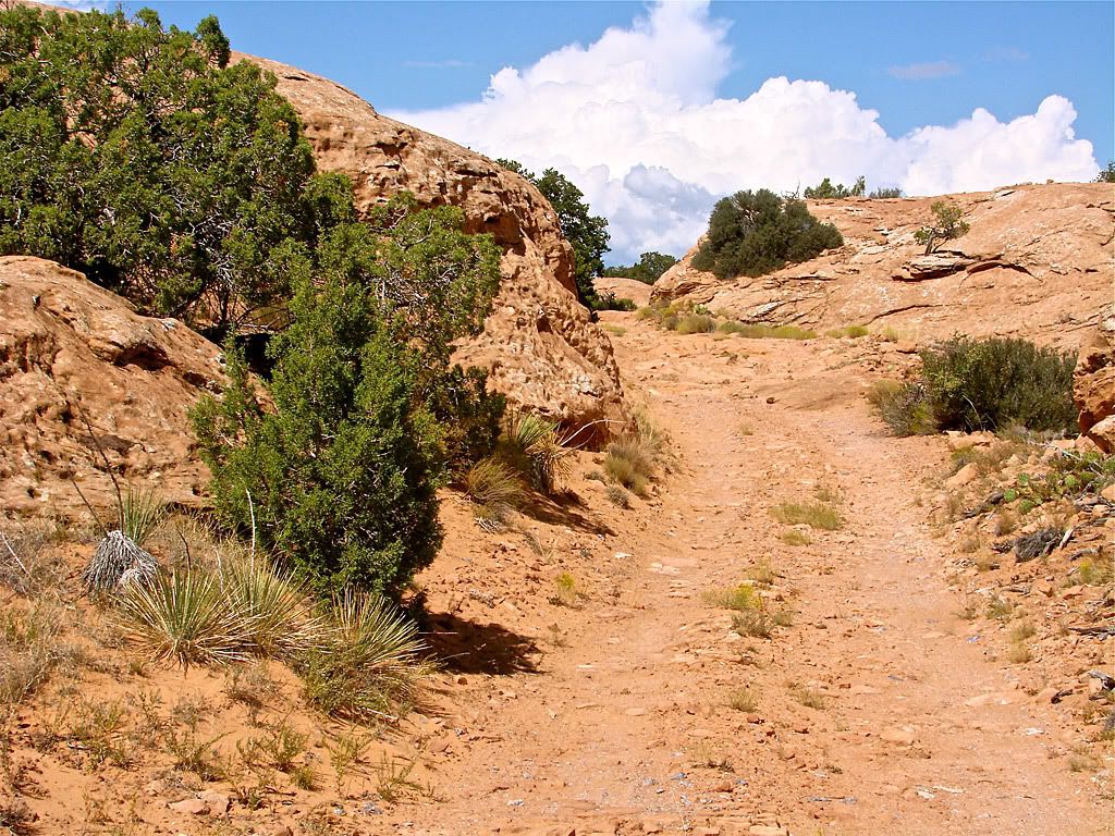
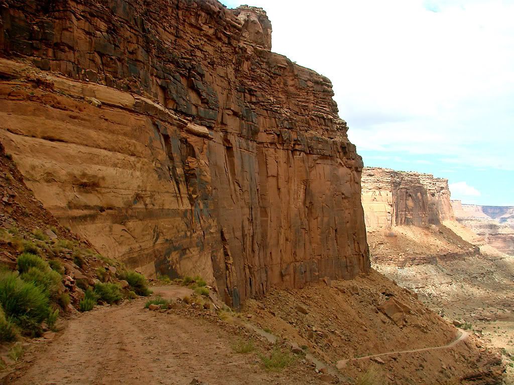
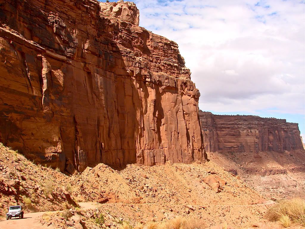
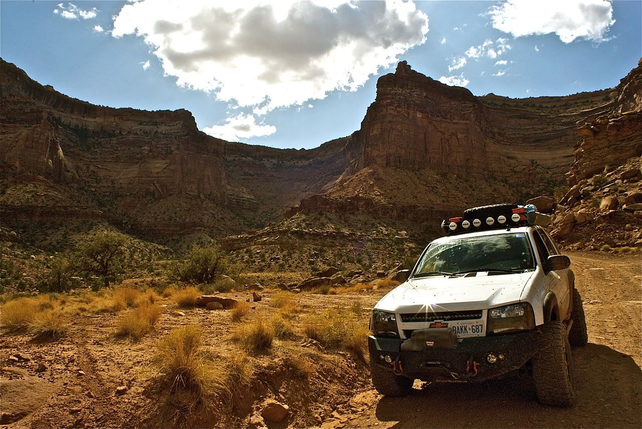
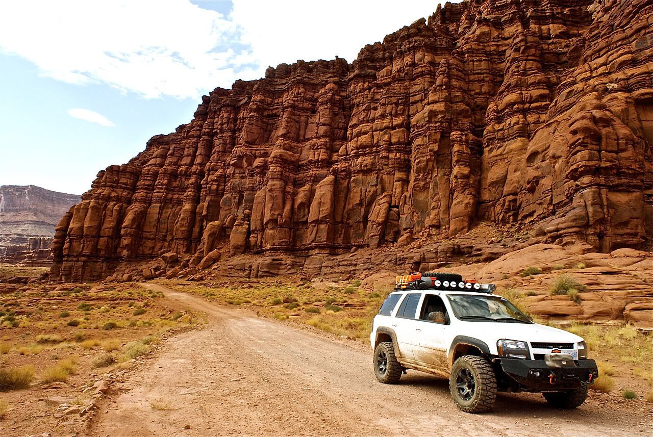
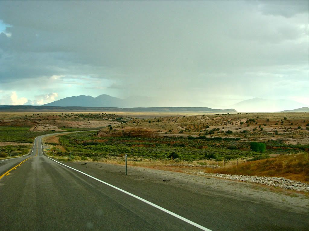
A bit past the turn-off, Shafer Trail leaves Canyonlands NP and continues east. The scenery just keeps going, its incredible.

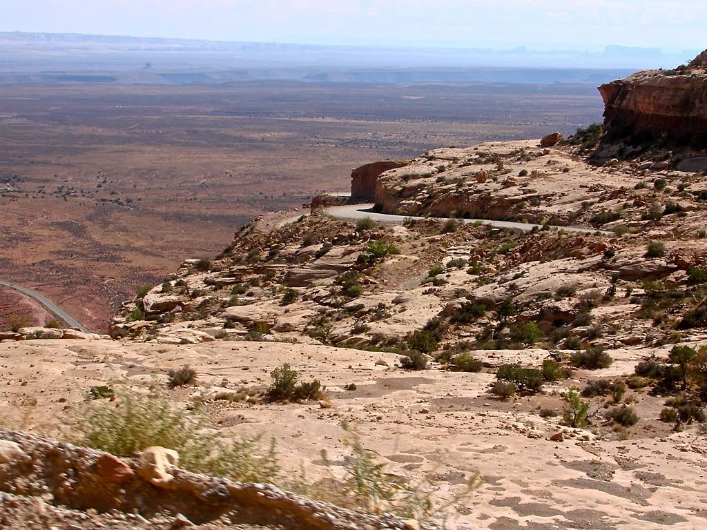
After taking some photos of the Shafer Trail descent, it was time to head on down. For the steep switchback parts, I was basically in 4LO - 1st gear all the way. This resulted in a nice slow descent with the use of the breaks kept to a minimum. I had one vehicle coming the opposite way so I pulled to the side of wide switchback and waited till they passed.
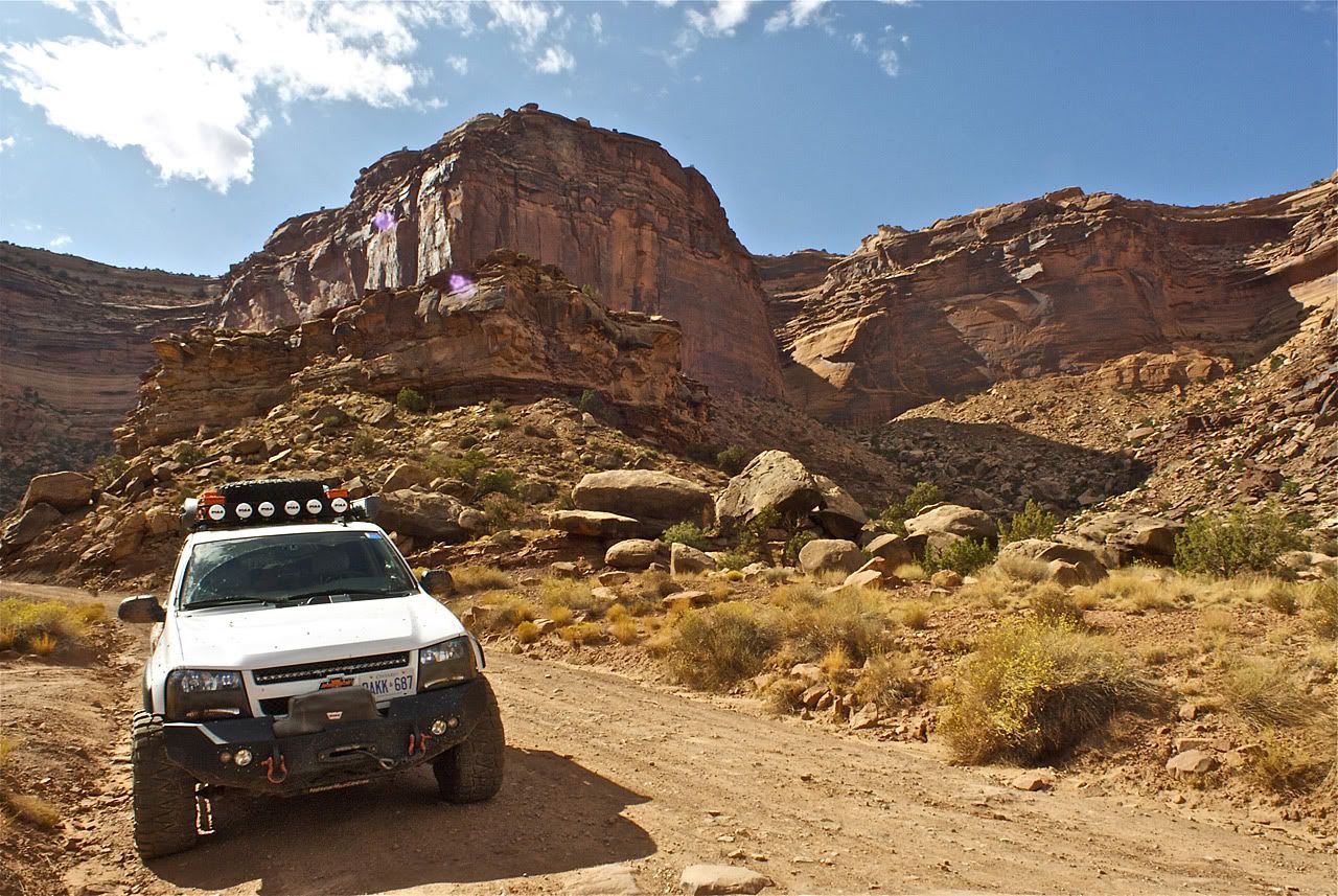
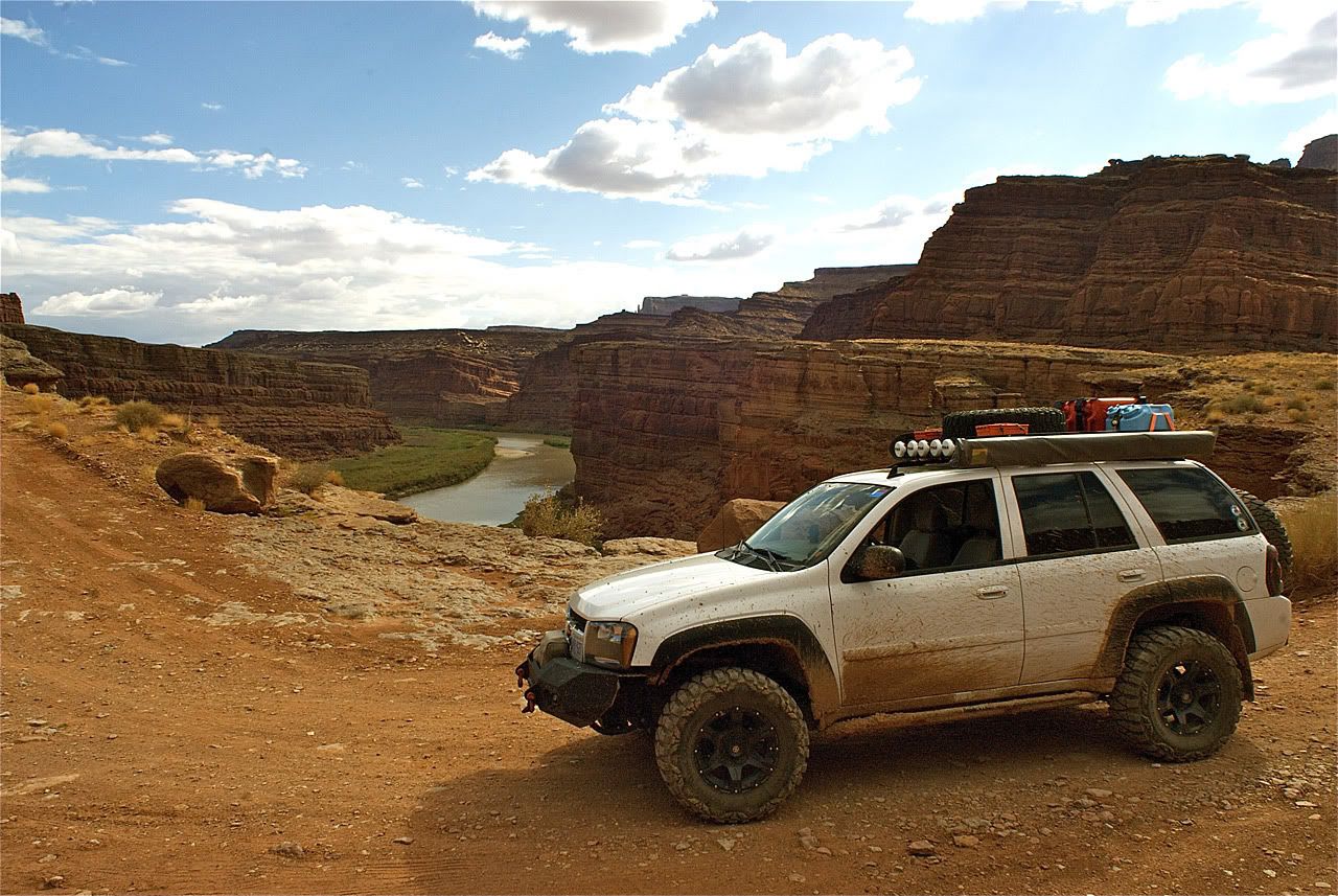
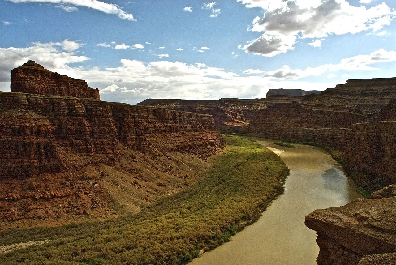
The trail continues along a cliff and comes up close enough to the canyon's edge to see the Colorado river below.
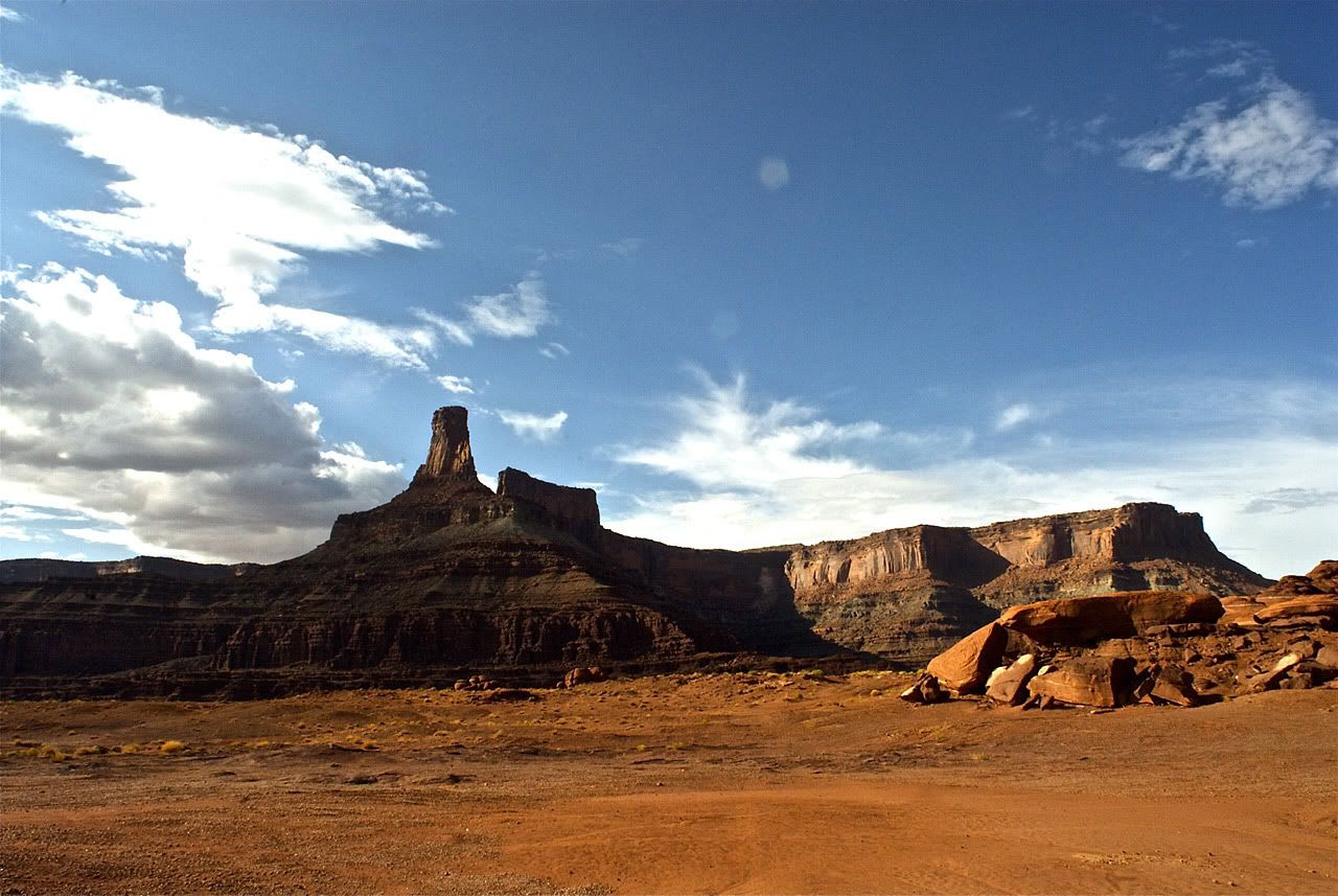
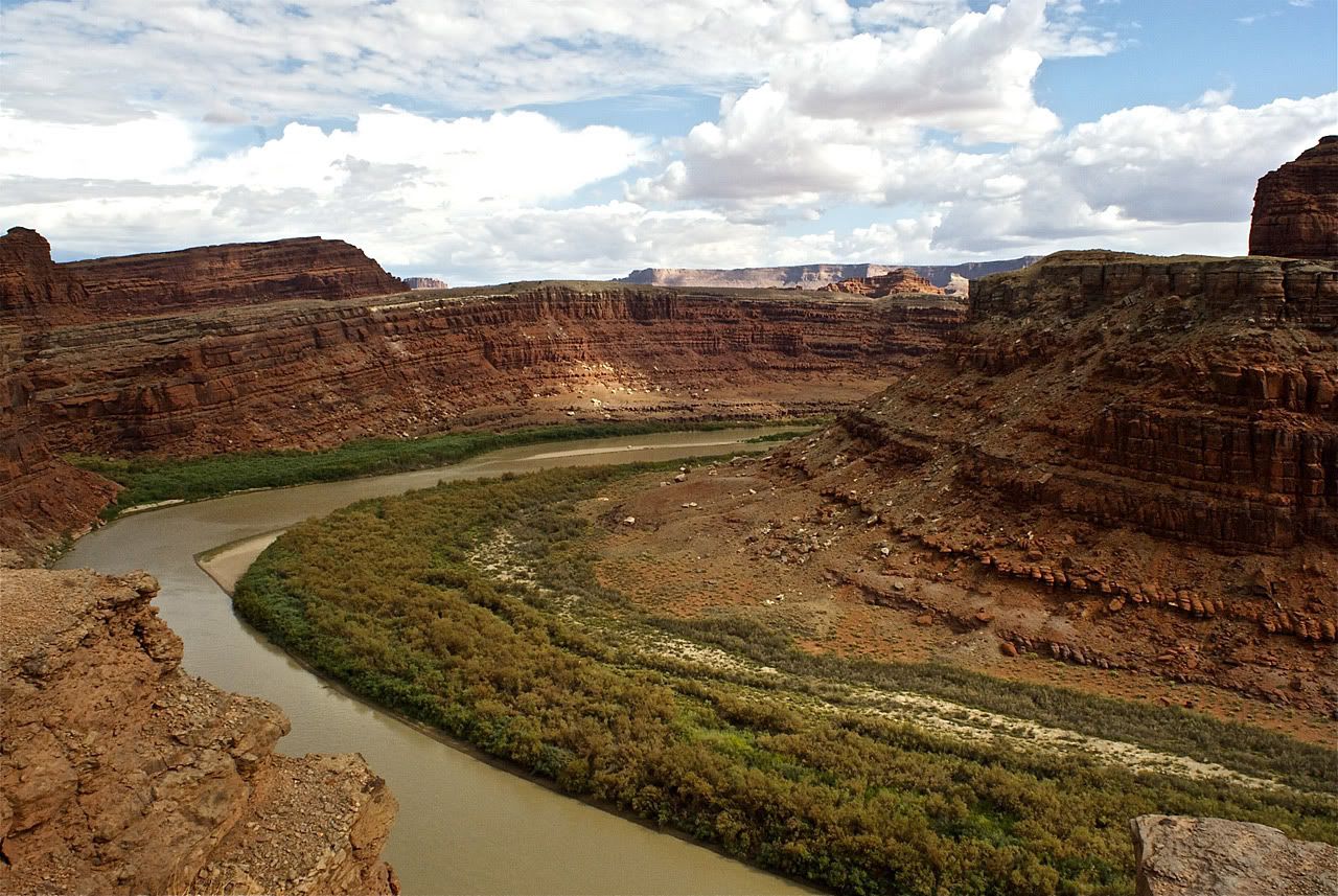
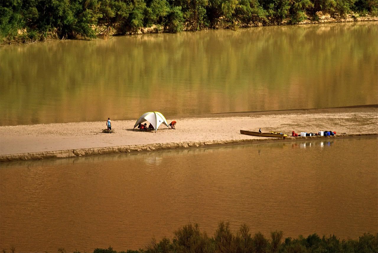
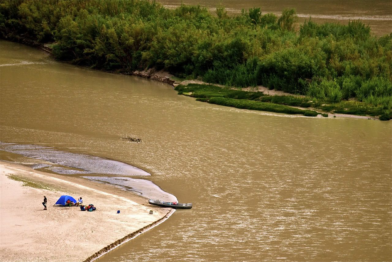
The next grand overlook was at the Goose Neck where the Colorado river almost doubles back on itself. Several vehicles were stopped here with a group of young Germans taking pictures and horse-playing awfully close to the edge. On the Colorado River below there were 2 separate river trips on opposite sides of the Goose Neck. So I got out my 500mm lens and took some photos. I believe both were setting up for the night.
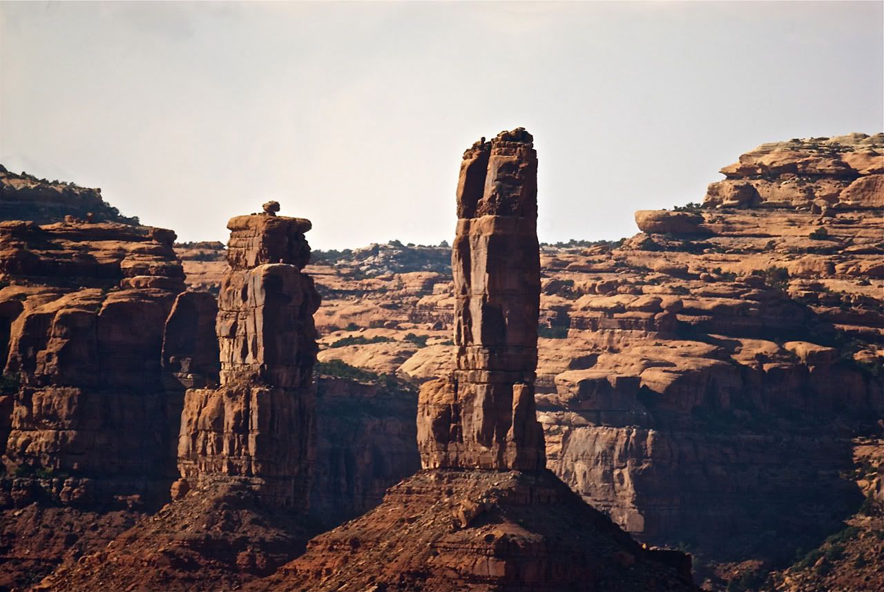
The final quarter of the Shafer Trail heads into private land, owned by a Potash producer. The border is right around Chimney Rock.

After this point the trail winds around the potash ponds and signs ask drivers to stay on the main road as other roads are private.

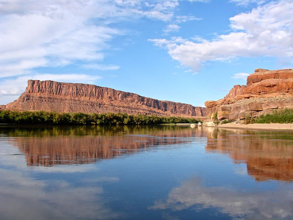
The Shafer Trail ends on Utah 279 which follows the Colorado River and heads into Moab. Just before pavement, there is access to the Colorado River, mainly for raft put-ins. I finally was able to dunk my toes into the mighty Colorado.
Its along this scenic byway where I spotted a rally of EarthRoamers set up at a campsite. It's feasible that I crossed paths with Scott Brady from the Overland Journal and his Jeep JK EarthRoamer. The thread on this board places him at Valley of the Gods right around the day I was there, the 18th. Small world!

You may ask why I didn't end up staying in Moab? Well it seems it was filling up for the weekend and I could not find a hotel at a decent price at all. So I ended up down in Blanding. On the way I ran into the tail end of some of those Utah monsoons.