X88 expeditions - Documenting and sharing overland travels, adventures, and expeditions

September 22, 2007

Colorado Expedition - Day 11 - Sep 19

I planned it so the drive today would be shorter, just in case there were hassles at the border. The weather totally cleared up and the temperature was into the 80s all the way through Michigan.

Map References - Day 11 - Sep 19

View Sep 19 track in larger window.
September 19 track:

* large files - 1800 x 1200

Over the St. Clair River from Port Huron, MI to Sarnia, Ontario.
The border guard did question me a little bit about the second spare, but seemed to understand after we talked a little about driving offroad in Colorado. No hassles overall.
Driving east on the 402 towards London at sunset.
Well, I'm back home with a lot of great memories from my first extended expedition. I will put some travel stats in the next post along with some brief technical notes about my Trailblazer and its modifications for those that are interested. See you OUT THERE.

Colorado Expedition - Day 10 - Sep 18

Today's drive took me from Nebraska, through Iowa, into Illinois just south of Chicago, and into Benton Harbor, Michigan where I stayed for the night.

Map References - Day 10 - Sep 18

View Sep 18 track in larger window.
September 18 track:

* large files - 1800 x 1200

Some real offroad vehicles in Lincoln, NE. I believe they have huge Reserve bases here.
A little more varied topography in Iowa.
Passing over the Mississippi.
The day's driving was mostly uneventful. I tried to stay ahead of the rain that was coming from the west but it eventually caught up to me. One interesting point about Iowa, all of their rest areas that have facilities, also have wireless internet access. You get 30 minutes for free, after that there is a charge. They have the nicest and cleanest rest areas I have ever seen.

Colorado Expedition - Day 9 - Sep 17

The weather cleared up in the morning which meant the drive on I70 through Colorado was expected to be easy going. The scenery along the way was actually much nicer than I anticipated, I70 goes through some very nice mountain valleys. It pretty much follows a river all the way through.

Map References - Day 9 - Sep 17

View Sep 17 track in larger window.
September 17 track:

* large files - 1800 x 1200

It goes over the Vail Pass first, then through the Eisenhower Tunnel to get to Denver. I stopped at the rest area just on the other side of the pass and got some good pictures of newly snow-dusted peaks. From my map I think they are the 14ers Quandary Peak, Mt. Lincoln, Mt. Democrat, Mt. Bross, with Breckenridge on the other side.
Driving down just before Denver.
Back on the flatland for another 3 days.
Casting long shadows at sunset in Nebraska.
I stayed in Lincoln, NE this night. Unfortunately there was another major storm at night so I got in to the hotel later than expected and in the middle of a downpour.

September 21, 2007

Colorado Expedition - Day 8 - Sep 16

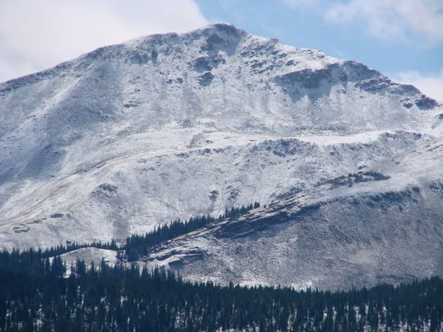
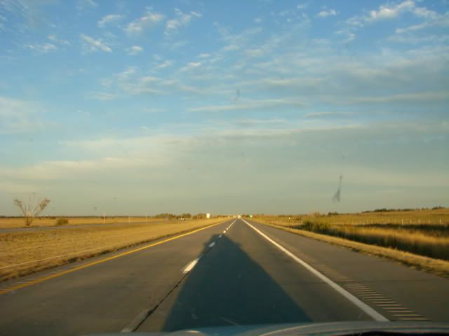
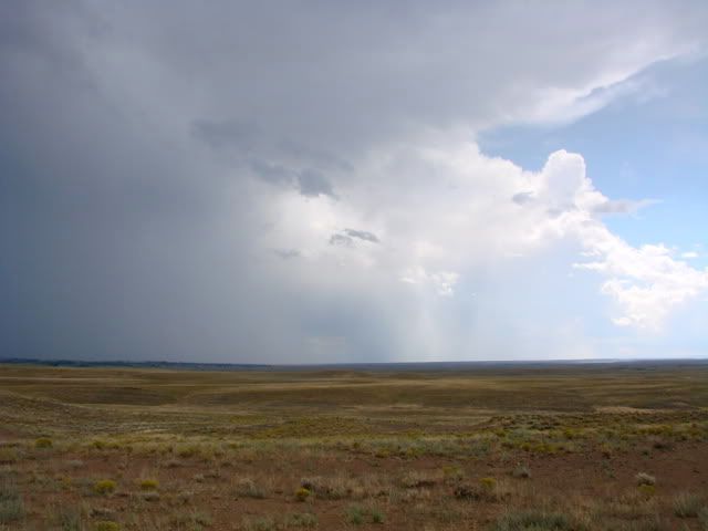
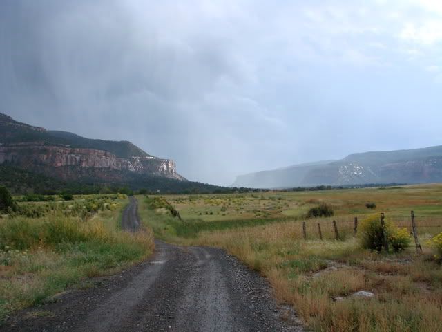
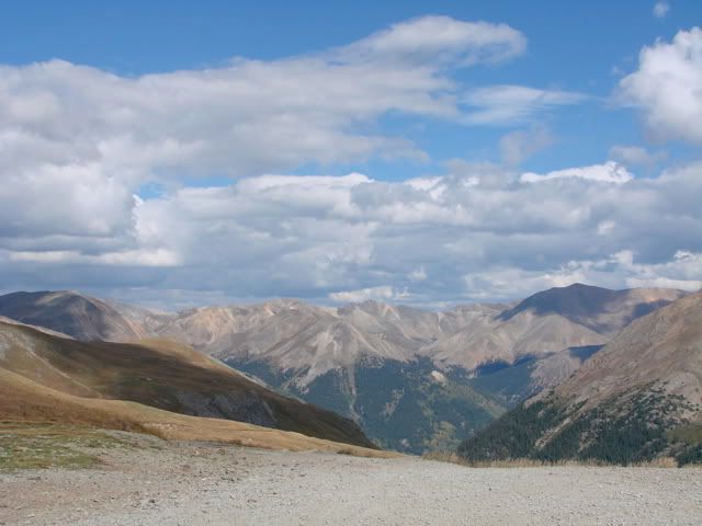
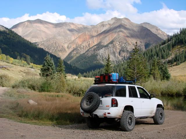
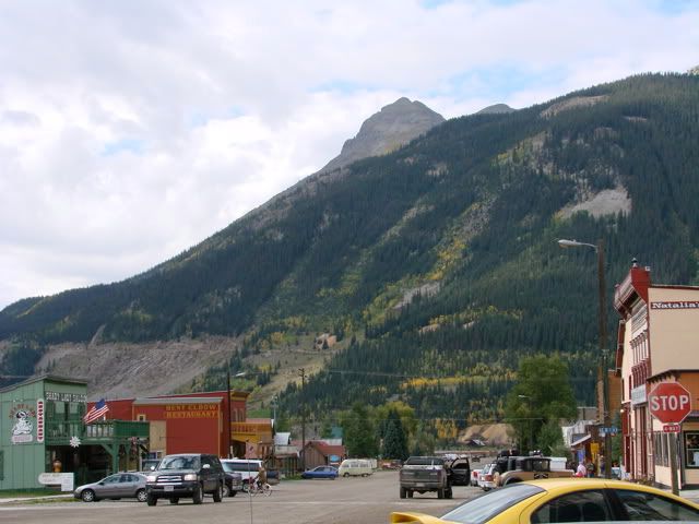
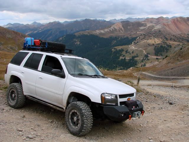
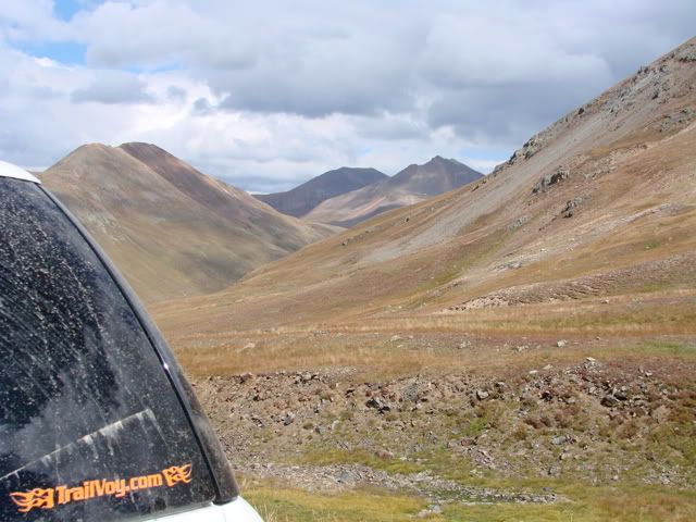
Today's plan was to head west out of Delta and to explore Escalante Canyon and the Uncompahgre Plateau. I would use 2 trails and half of the third one which would leave me in the town of Montrose, ready for the drive up to Glendale Springs where I would stay tonight. Problem was that as I started getting the Trailblazer ready at the hotel, a heavy rainstorm moved through, causing me a half hour delay while I waited it out. Even worse, there were storm clouds all over the horizon in all directions so I wasn't even sure I would head out today. But as the weather cleared I decided to at least head out to the first trail and see how it went. These shots are from the the Escalante Rim Trail which starts on the plateau west of Delta and then drops into the Canyon. The storms were all moving from west to east with lots of wind and lightning. I waited it out a bit and finally could see clear skies up ahead to the west.
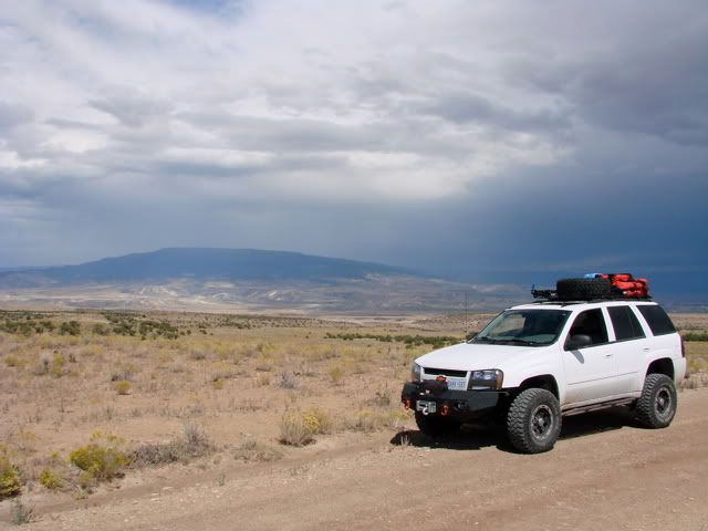
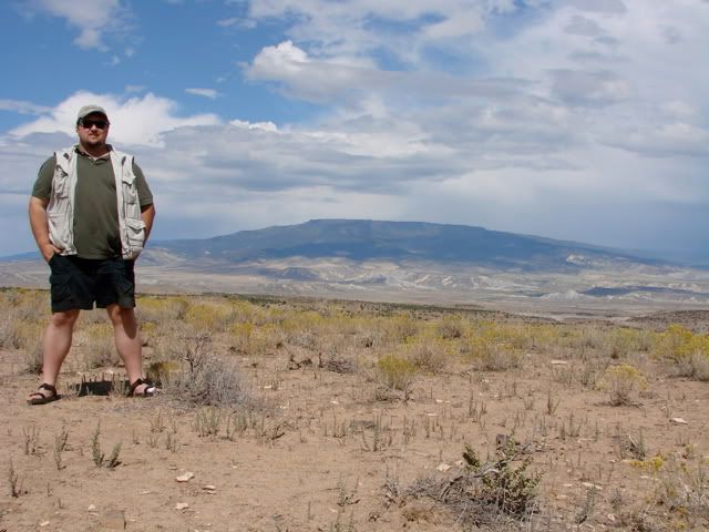
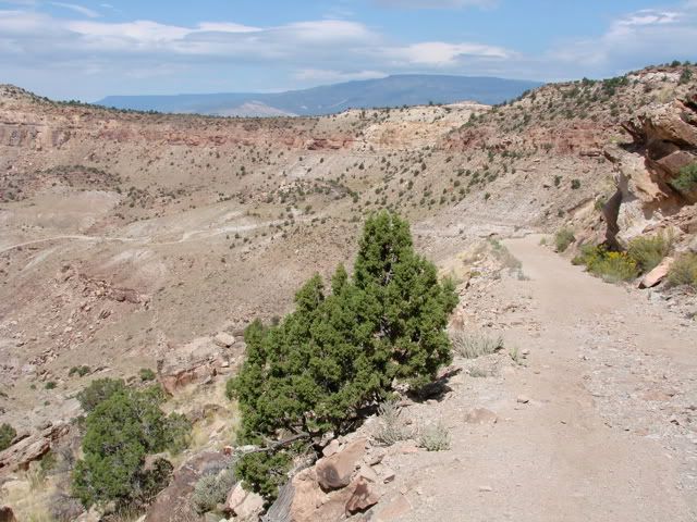
Just before the shelf road that takes you down into the canyon, there is a great overlook. The shelf road is stable with not too many loose rocks. There are a couple of switch-back areas but I had enough room to not have to reverse.
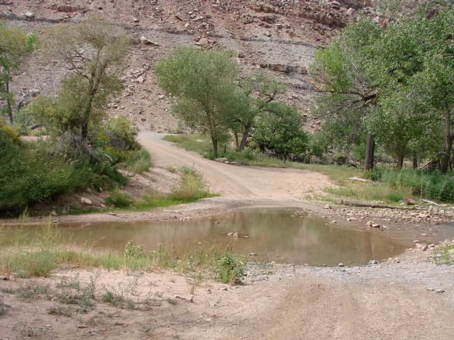
At the end of the trail, it passes through Escalante Creek which has a warning for sudden water level changes and flash floods. I was worried that the rains would make it impassable but luckily it was at a normal level. Because of the constant threat of rain, I decided to take the easier of the trails south.
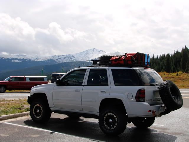
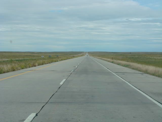
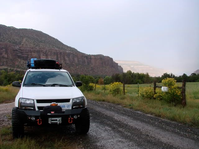
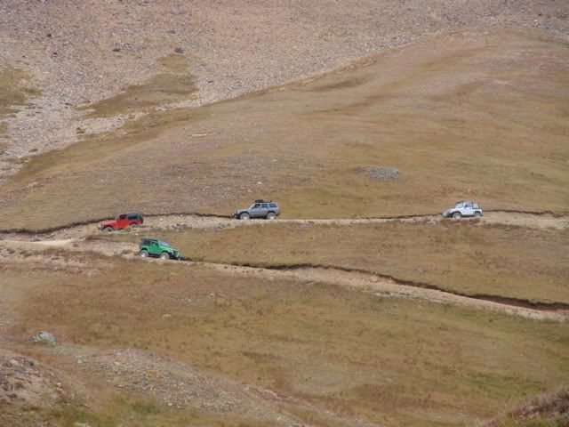
Escalante Canyon Road runs parallel to the harder Dry Mesa Jeep Road which has a very steep section as it goes up (or down) the Escalante Canyon wall. Escalante Canyon Road on the other hand runs mostly through the bottom of the canyon and climbs out of it later with less severity.
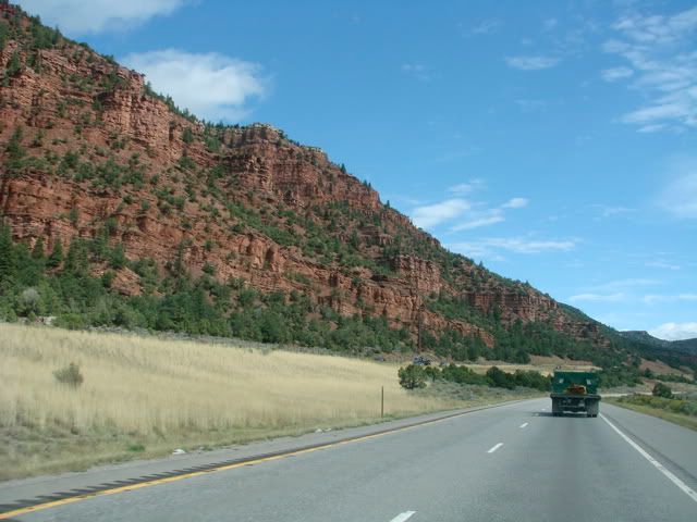
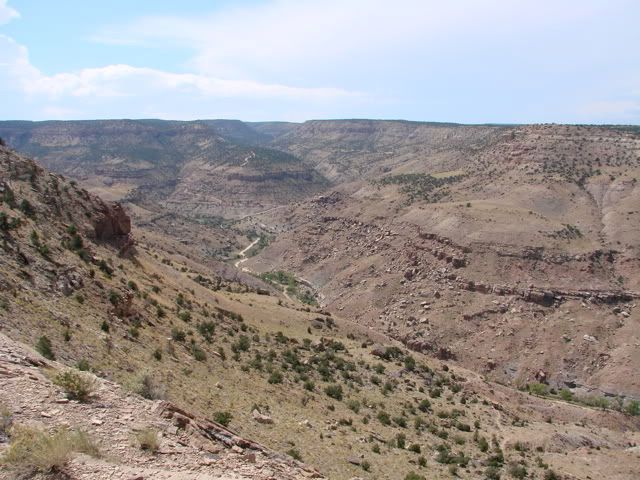
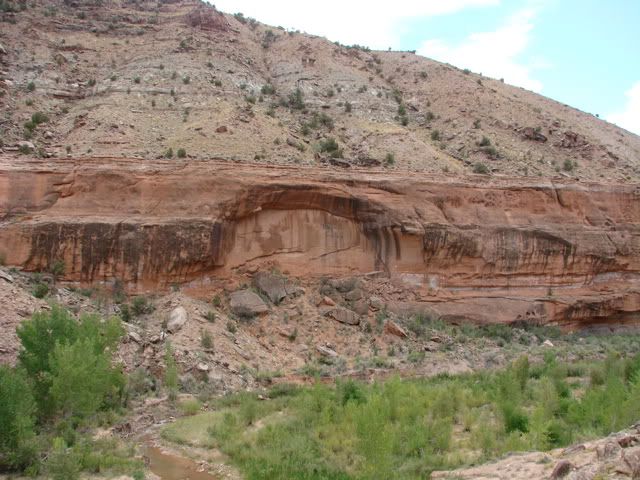
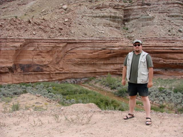
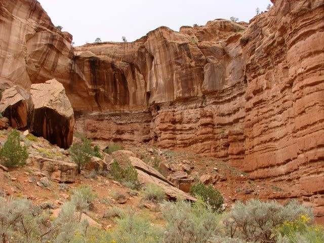
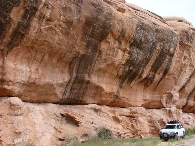
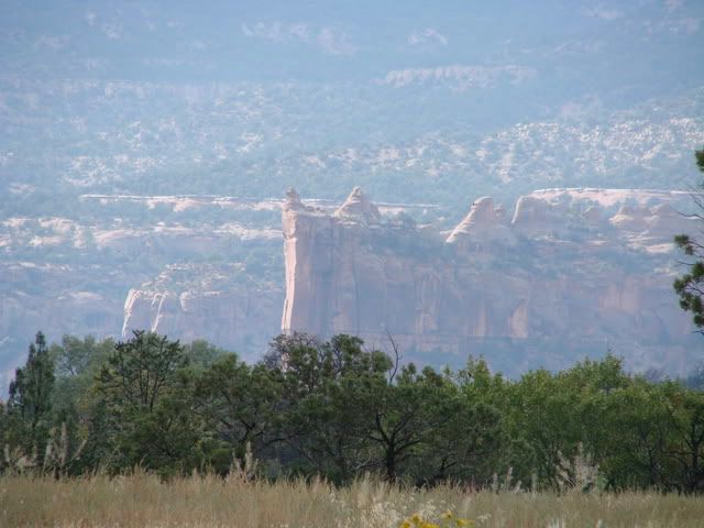
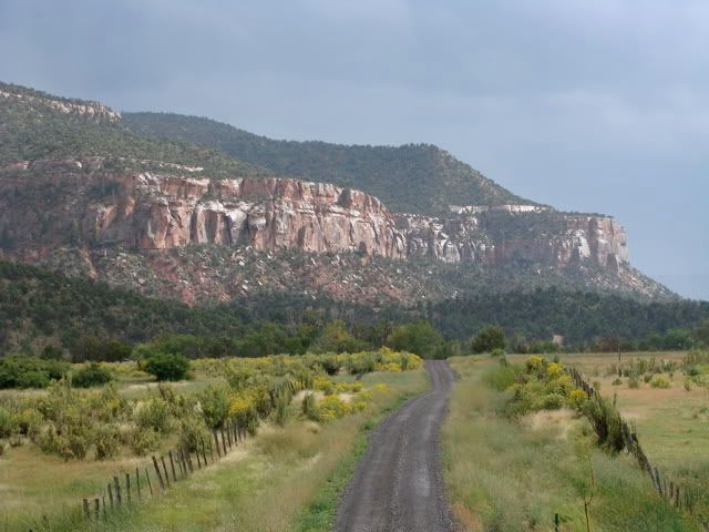
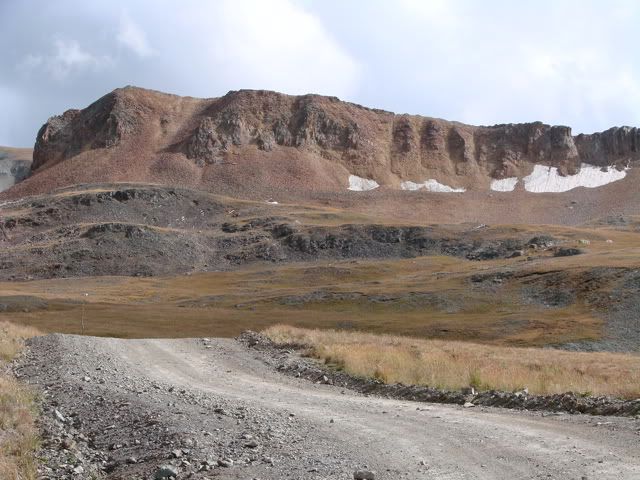
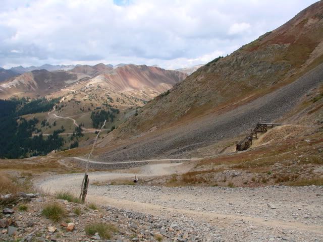
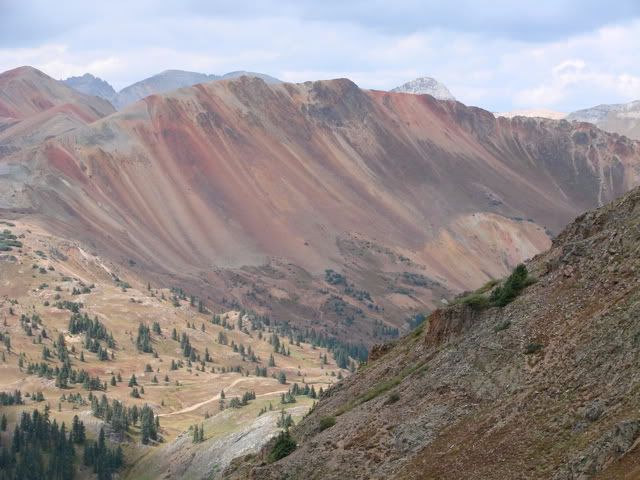
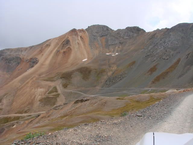
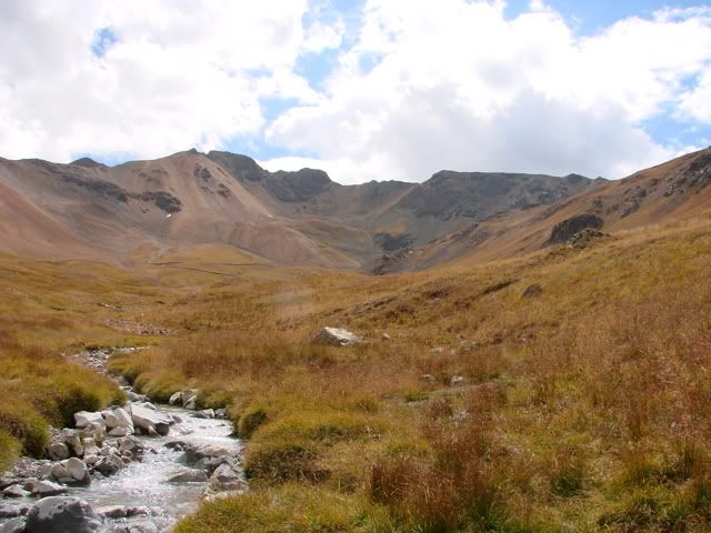
There is plenty of interesting geology along the trail.
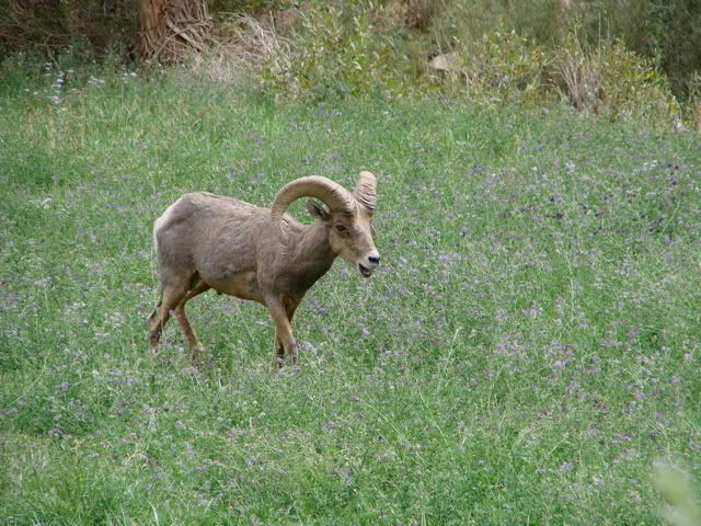
More bighorn sheep, except these were in a pasture.


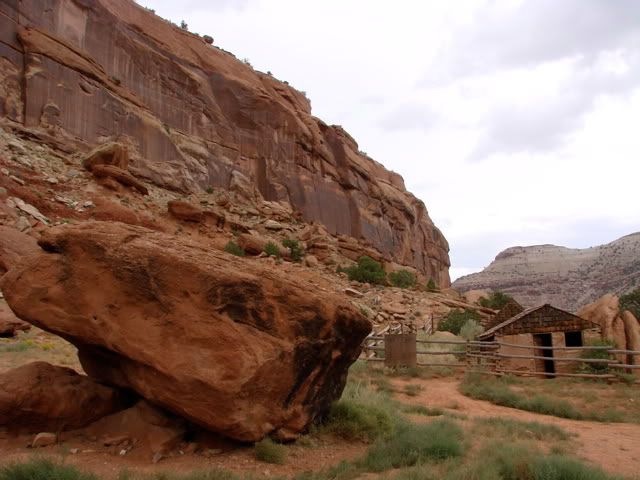
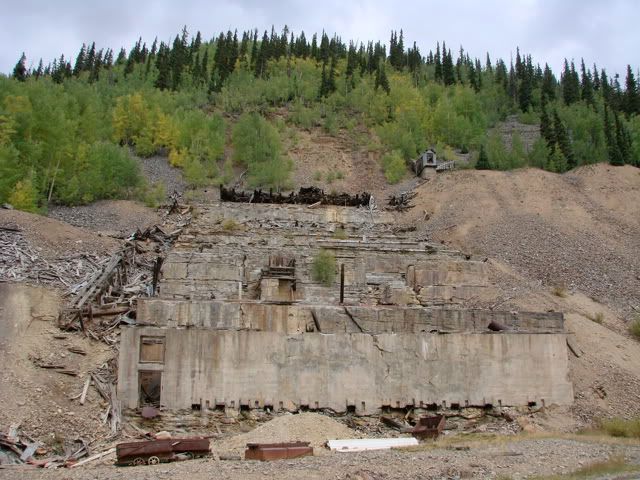
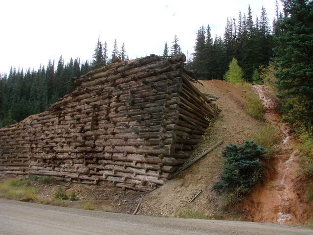
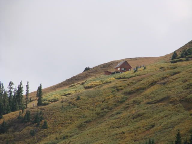
An interesting stop is Captain Smith's Cabin which is between the road and the canyon wall.
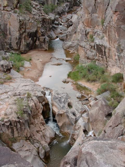
I could see lightning in the distance and hear the thunder so I could not hang around too long. The potholes are areas of Escalante Creek up to 11 feet deep where there is dangerous swirling water currents. The geology in the area allows the erosion of the softer rock to create these holes. Lots of signs warning of the dangers of swimming in the area, although it would be a nice area to take your time and climb down to.
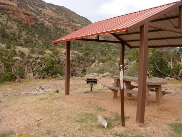
The threat of rain kept increasing as I headed south. I stopped at a very nice set of campsites that are above the potholes as they call them.
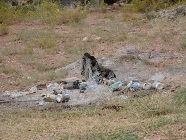
Unfortunately some careless visitors left the campsite littered with cans and a piece of wood glowing red due to the wind picking up. I decided to do my good deed for the day and doused the log with water and picked up the cans to take out of there. The campsites are great by the way.
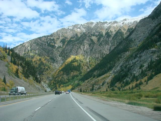
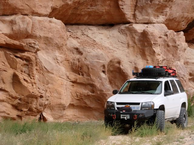
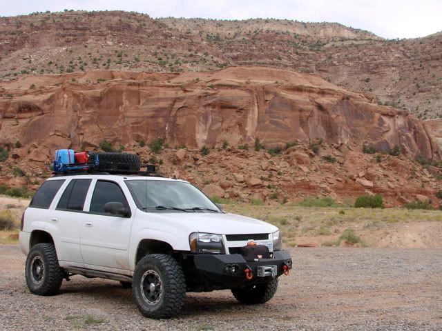
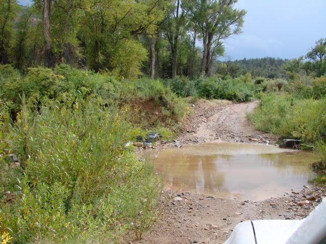
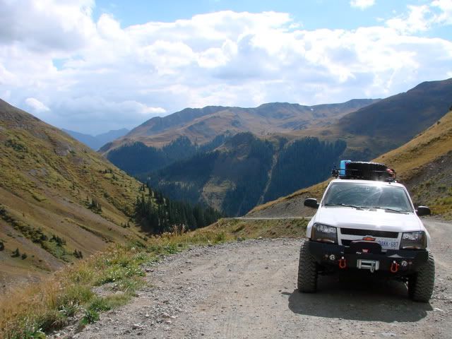
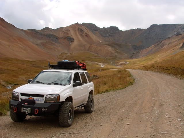
Further down the trail is when the rain actually started. First just a sprinkle but then it started to come down heavy enough that I had to close my windows. At first I continued as the road is gravel and posed no problem for the Mickey Thompson's. During breaks in the rain there were some great photo ops in the canyon.
However, soon after this creek crossing (which seemed to be getting deeper by the minute) the road enters Uncompahgre - Gunnison National Forest and turns into a dirt road and not gravel. Problem was that with the rain it was no longer dirt, but about an inch of sticky mud. At first I slogged through it but as I got to steeper parts, the Trailblazer started to slip and slide. You see, the deep tread of the Mickey Thompson's started to fill up with mud and thats when things can get tricky. A blast of the throttle will clear them out but this has to be done quite often. So I had to make the decision to turn back as all I could see was rain in front of me and according to my guide book, I was coming up to the part of the trail that climbs up the canyon wall to the plateau. Even though it is not supposed to be that steep, I decided to play it safe as I was alone and the day was growing short.
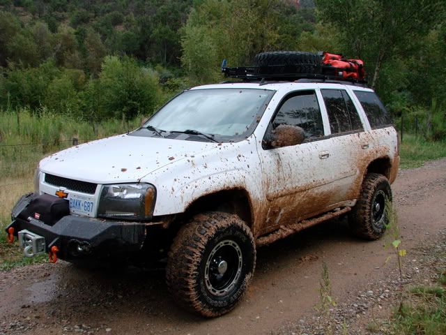
This is what the Trailblazer looked like after only 15 or so minutes in the muddy part of the trail.

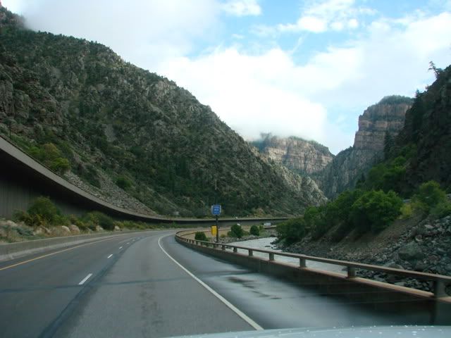
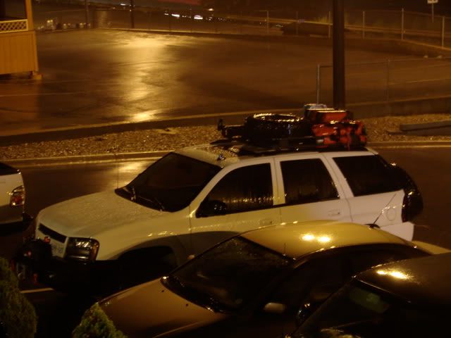
The drive back north was uneventful and I made it back to Delta. First thing I did was to locate a coin-op car wash and clean that mud off. Let me tell you it was the stickiest mud I have ever seen, sometimes I had to hold the high pressure jet an inch or two away from the clump just to blast it off the body. Now, I don't have any pictures from the Delta to Glenwood Springs drive because as soon as I got out of Delta and into the Elk Mountain Range, I hit a constant, unrelenting downpour. If you haven't driven over a high mountain pass through a lightning storm, I wouldn't suggest you do. Some of the lightning hits were so close and bright that I had to to shut my eyes for a split second, during which I could hear the thunder, so I new it was close.
On top of that I had to watch out for and avoid at least 4 or 5 rock/mud slides that made their way onto the road. And to top it all off, people insisted on driving 50 or 60 mph in areas clearly marked 35 and 40 for a reason. I had to pull over 3 or 4 times just to get them off my tail. The good news is I made it to Glenwood Springs and checked into a nice hotel. The Trailblazer sure looked clean in the parking lot. Well, tomorrow is a sad day as I start on my 3 day trip back to Toronto. Overall it was an absolute great experience in Colorado. I achieved my goal of seeing and driving through 3 distinct parts of the state. My vehicle and modifications passed with flying colours. I can't wait to start planning my next expedition. First things first, I will report in from the trip back.

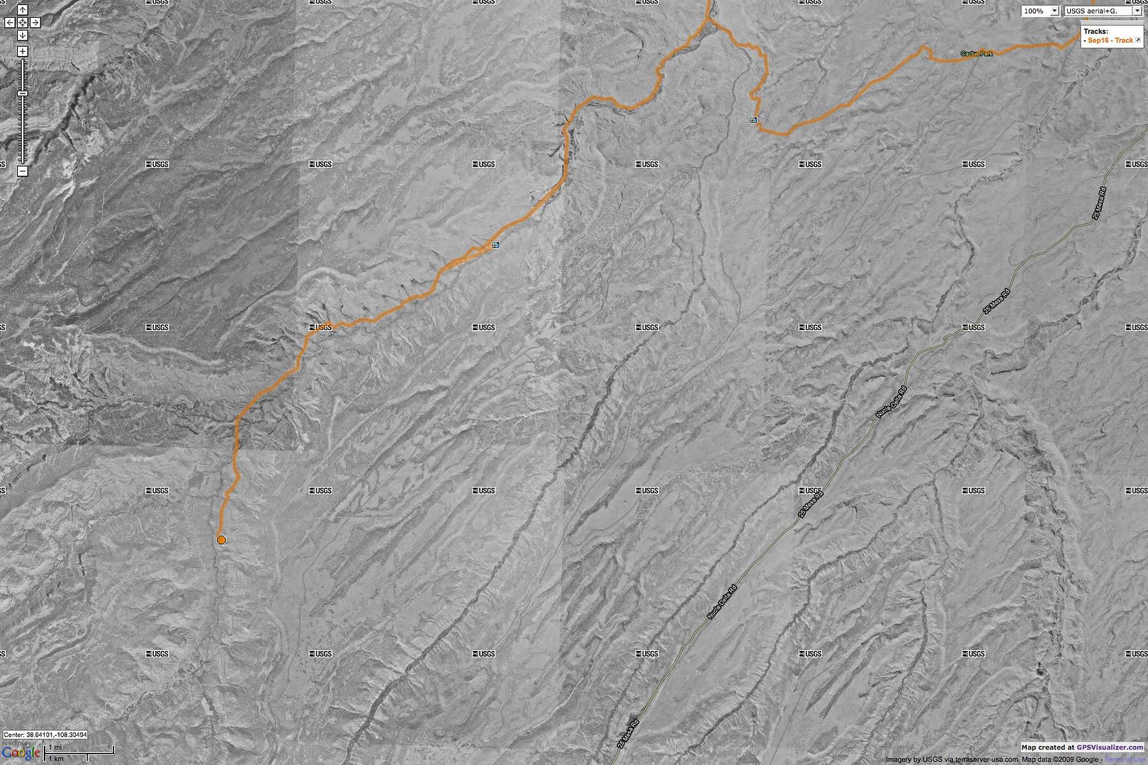
Map References - Day 8 - Sep 16

View Sep 16 track in larger window.

September 20, 2007

Colorado Expedition - Day 7 - Sep 15 - Part II

Cinnamon Pass Trail is part of the Alpine Loop which also includes Engineer Pass Trail. I would only be taking Cinnamon today as that would lead me out to pavement and onto my stop for the night in Delta. The trail begins the climb right away with Animas Forks down below. Again, lots of ATVs and motorcycles out on the trails today.
The weather cleared up a bit once I was at the pass at 12,640 feet so I stuck around taking some pictures and talking to people from a couple of other vehicles already up there. Some snow remnants even this late into the Summer.
The drive down from Cinnamon was interesting as there was quite a bit of traffic headed up. Observing 4WD etiquette I tried to let all of those travelers by without getting too close to the edge! There is some more excellent back country camping along the trail once you get below the tree line. Here is a nice view of Redcloud Peak I think. I relaxed here for a while and snapped a photo of a jet overhead, they sure look closer than where I come from!
Further down close to a nice camping area, I ran through some colour-changing aspens.
The trail ends in the town of Lake City, where I started my drive up to Delta. Half-way there the road passes beside and over the Blue Mesa Reservoir which I was reaching just at sunset.

The rain started after this and the rest of the drive to Delta took longer than expected, but I got to the hotel OK. Tomorrow the plan is to drive Escalante Canyon.

Map References - Day 7 - Sep 15

View Sep 15 track in larger window.

Colorado Expedition - Day 7 - Sep 15 - Part I

The night drive north to Silverton was mostly uneventful. The road can be a bit deceiving though, if you are not careful the steep grade can speed up your vehicle and then you are in trouble. There were some emergency vehicles out after the pass (which my GPS told me was at 3330 meters) which were dealing with an overturned 18 wheeler that could not handle the sharp turn. I hope the driver was OK. Driving into Silverton this late in the season and at night was somewhat of a surreal experience. It almost looked like a ghost-town except for the 2 or 3 bars open late. After I checked in to the bed and breakfast which I reserved earlier in the day, I decided to take a stroll through town. It ended up that there were some vacancies at the more rustic places along the main street, but I didn't want to take a chance of not finding any rooms so I was staying at The Inn of the Rockies at Alma House. As I walked down a mostly deserted street I heard some great blues/jazz fusion coming from one of the bars so I popped in to take a look and grab some refreshment. The Pride of the West Restaurant and Bar was a great change of pace to all the driving I have been doing.
My plan for today was to head out of Silverton and combine a few trails that would ultimately get me back to pavement for my drive up to Delta tonight. Here is a picture of the 2nd main street, only the 1st main one is paved. This is where most of the tourists end up first after disembarking from the narrow-gauge railway that goes from Durango to Silverton.
I chose the Silverton to Lake Como trail (rated 4) which takes you north out of town along Cement creek. There are various building ruins along the way. But once you get to the modern mine in operation, you take a left and the real trail starts up to Hurricane Pass and Lake Como.
The trail you see coming out of the Red Mountain Peaks is Corkscrew Gulch Trail which leads back to the Million Dollar Hwy.
As you can probably tell, the weather was not the best as the winds picked up and the clouds started to come in. I had to finally put on some track pants and a windbreaker (first time other than that cold night camping). At least the rain stayed away. Here's Hurricane Pass at 12,407 feet.
Just after you crest the pass, there is a short shelf road down to a 3-way intersection and a nice view of Lake Como. It was interesting that there was quite a bit of traffic going on here. While I was parked and taking pictures, 3 other vehicles stopped, 2 "tour jeeps" came out of Poughkeepsie Gulch (this is supposed to be a very tough trail, not even in my guide book), at least 4 motorcycles came through, and a party of 5 ATVs! A regular traffic jam.
The trail I planned to continue with is not marked on the sign, its California Gulch Trail with California Pass at 12,930 feet a short distance up the mountain. I believe this will be the highest point I will reach on this trip. Just under 13,000 but I guess I will have to save that for next time! A couple of tight switch-backs forced me to reverse here and there. I probably did not need to but this kind of driving is new to me so I decided to stay on the cautious side. You can see the pass up and behind the Trailblazer. I stopped here as there was really not that much room at the pass and I didn't want to block anyone. Then the trail continues down the mountain and into the basin.
Once down into the basin, the driving is a little easier on the nerves. I stopped at a wide part in the trail and walked to the creek flowing down from the mountain. I thought about taking a drink but decided not to, still had a few hours to go and didn't want to take any chances. I sat next to that creek for about 20 minutes waiting for the clouds to clear so that I could get a shot in the sun.
Very relaxing ...
More vehicles coming through and a view down the basin.
California Gulch Trail ends at the well-known ghost town of Animas Forks. Its very well preserved and there is 2WD access (in good conditions) from Silverton so there were many vehicles in the parking area.
The final leg for today was going to be the Cinnamon Pass Trail.


Now that's a mountain cabin!