X88 expeditions - Documenting and sharing overland travels, adventures, and expeditions

May 30, 2009

Reynolds County Courier - April 2009

After attending the MORA weekend in south-eastern Missouri, we received word that the local newspaper ran a story on our club get-together and the events for that weekend.

The story talks about various aspects of what happens at these kinds of events, how far attendees travelled to get there (California and Ontario, Canada), and provides some pictures.

May 25, 2009

TECORE to MORA - Video

This was the first extended trip where I shot some HD video on my Sony HVR-A1U. Its a great compact HDV camcorder with an outstanding workflow for processing, editing, and outputing the video. Apple's Final Cut Studio can work with the files directly in real time so there is usually no need to transcode to a different video format. More on this in an upcoming Equipment section.

The video has 3 parts:

  • scenes from TECORE in Virginia
  • some shots from the beach at the Outer Banks in North Carolina
  • and finally verious clips from MORA in Missouri

Some of the shots were taken when I was experimenting with the Fat Gecko suction cup mount.

Music
Ride Like Hell
by Big Sugar
High Road Easy
by Sass Jordan
All music © by respective holders.

This non-commercial video includes the transformative fair use of copyrighted material as part of a personal reportage.

High Definition Versions
File Size: 383 MB
Resolution: 1280 x 720

Video codec: H.264
Audio codec: AAC
Duration: 9:28

File Size: 202 MB
Resolution: 852 x 480

Video codec: H.264
Audio codec: AAC
Duration: 9:28

Learn more about QuickTime 7.

May 20, 2009

TECORE to MORA - Day 11 - Apr 27

I was hoping to wake up early on the final day and make it to Allegheny National Forest for some afternoon exploring, but I guess I was very tired. I slept in and left the hotel around noon.

I stayed on the smaller Highways for about a third of the day, bypassing Columbus to the south. But soon after I joined up with I-70, headed over to Pittsburgh, north to Erie, then Buffalo, and finally home.

Some random shots from earlier in the day.

Map References - Day 11 - Apr27

April 27 track:

* large files - 1800 x 1200

View Apr 27 track in larger window.
Overall it was a great trip with mostly great weather. I got to see quite a diverse set of scenery. And most important I got to meet up with lots of fellow Trailvoy owners, particularly theRoadie.

My next expedition was going to be to Newfoundland on the east coast of Canada beginning of July, but that is now in question due to various things.

Carlisle at the beginning of August is still pretty much a lock. And I am really trying to make sure I can make my BIG expedition to Utah starting Labour Day weekend.

May 19, 2009

TECORE to MORA - Day 10 - Apr 26

After an adventurous and interesting Saturday, I started packing up camp getting ready for the one and a half day trip home. The Roadie was staying an extra day so we decided to go down to the river to take some pictures.

Map References - Day 10 - Apr26

April 26 track:

* large files - 1800 x 1200

View Apr 26 track in larger window.
Then we went on a trail that Roadie and ToyBlaze scouted out a couple of days before which at first impression, seemed it definitely needed a lift and 32s or 33s. It was quite interesting with some creek crossings, a drive through the creek, and some hill climbs. There was no mud though as the area seemed to have dried out a bit.
Here's the farewell shot.
One of the decisions I had to make for the trip home was how to get over the Mississippi. Looking at the map I realized that there was no abundance of crossings ( well duh! ) Its just that its easy to forget the magnitude of the river and that there's not going to be bridges everywhere.

I really didn't want to go all the way up to St. Louis and if you look closely at a map, you will see that there is no other bridge for around 60 miles south, down at Menard.

Ahhh, but wait a minute, there's a ferry crossing right on my way back home. When I got there it sure was interesting ... a little 4 or 5 vehicle ferry that zips across the river for 10 bucks.

After the ferry it was north to Hwy 50 and east to a Comfort Inn just outside of Cincinnati.
I mentioned at first impression because Roadie later told me that he went back to the trail with a stock Trailblazer and they had no problems. So that leads to thinking whether all your mods are justified.

I look at it this way:
All my mods are functional and are ready for that one time when the trail or the conditions or the circumstances actually end up requiring them ... for peace of mind if you will.

TECORE to MORA - Day 9 - Apr 25

There was good attendance in Ellington, local and from afar. The farthest being theRoadie form southern California. I think I was second being from Southern Ontario, Canada.

Lots of interesting discussion, great to have met so many Trailvoy owners, some curious locals came out, there was the BBQ, and the raffle. A good cross-section of Trailvoys was represented.

Map References - Day 9 - Apr25

View Apr 25 track in larger window.
Thanks again to bentcougar for starting the whole thing rolling way back in September. And a big thanks to ToyBlaze and everybody else who helped out in keeping it going (and for the Banjo music).

After the BBQ Big Ed presented the Roadie and me with some great plaques for attending from so far away. Thanks very much again to Big Ed and everybody else, it was a really nice thing to do.

And finally a big thanks to High Voltage for the Trailvoy.com Offroad decal. It looks great up on the windshield, more pictures with it on my trip home.

Here are some more posts with pictures from the meet, the campground, all the various Trailvoys, the plaque presentation, and finally some scans of news of the event in the local paper.

More Pictures 1
More Pictures 2
More Pictures 3
More Pictures 4

Entire MORA picture and video thread

In the afternoon 12 vehicles headed out to some trails that Roadie and Toyblaze scouted out. Here is the convoy on the pavement.


One of the numerous water crossings.
Some group shots when stopped.
After the fairly tame trek, it was decided to head out on road 33 which was muddier, narrower, and more challenging. Please note that I have left out any particulars of this decision as I was in the middle of the group at the time and it has been discussed at length in another forum.

I do have to say that the trail/road that continued further was much more interesting and exciting with the deeper water crossings, muddy terrain, hills, etc. This came with a price though as we were flying by the seats of our GPS units and going down unexplored territory.

This last picture however is coming up to the now infamous "Bridge Over the Current River". How did Roadie say it? We were "thwarted".

Again, this was all discussed in another thread. Two things in particular stuck in my sides though:

  • GPS and Topo maps - Every single map, including Google shows a navigable road across the river. Maybe in the summer or autumn when the river is low it is fordable, but it should be marked as intermittent as a minimum. It didn't help that the OnStar lady (I called while we were waiting to hear back from the authorities) said to "turn around and take the bridge over the river to Hwy V". Sheesh!

  • Emergency call - I thought it was a good idea we called. For me, all I wanted was confirmation from the Forest Service that the road we were on (County Road P-235) was going to remain the same quality (graded gravel) all the way north to the highway. If we got that info back right away, we could have driven ourselves out of there.

But in any case, we ended up meeting the forest rangers on patrol which very graciously escorted us out in the dark.

Looking over my GPS tracks at home was fascinating. I marked 2 spots where we went in a particular direction, both of which took us further away from major roads and deeper into the brush with the Current River being the major obstacle. The zoomed in Garmin track shows one turn where going the other way would have taken us out to Hwy B, and another where going the other way would have taken us out to Hwy 106.

The other thing that the track shows is how very far going north to Hwy 72 was. This is what I saw on my GPS at the time, miles and miles of road with more than a few crossroads. That's why I really wanted to get the road quality information before heading out.

May 18, 2009

TECORE to MORA - Day 8 - Apr 24

Today was an all travel day - about 500 miles. I wanted to make sure that I would get to the campground by daylight so I wasn't setting up in the dark.

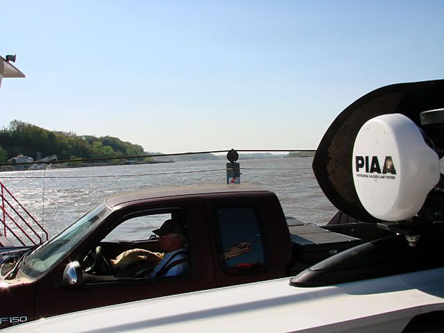
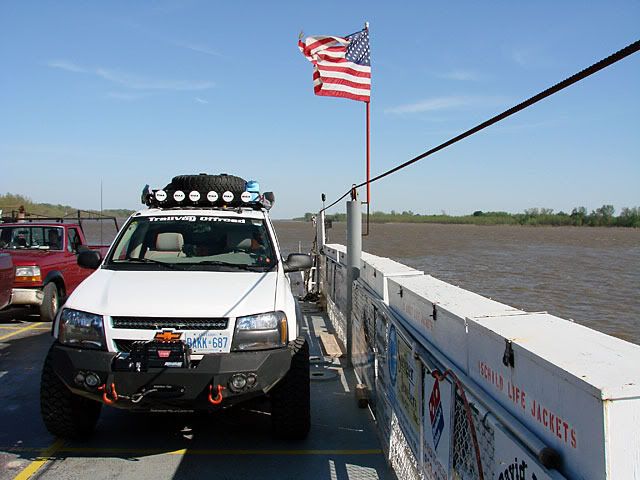
The Garmin GPS took me across Tennessee, through Nashville, up into Kentucky and Paducah, through the south-most tiny tip of Illinois, and then into Missouri. One of the more interesting sights was the confluence of the Ohio and Mississippi rivers. I now wished I had stopped and taken some pictures as it truly was an awesome site but I was weary of making it to camp by daylight. Here's a close up on Google Maps though.

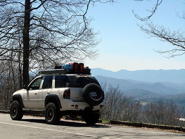
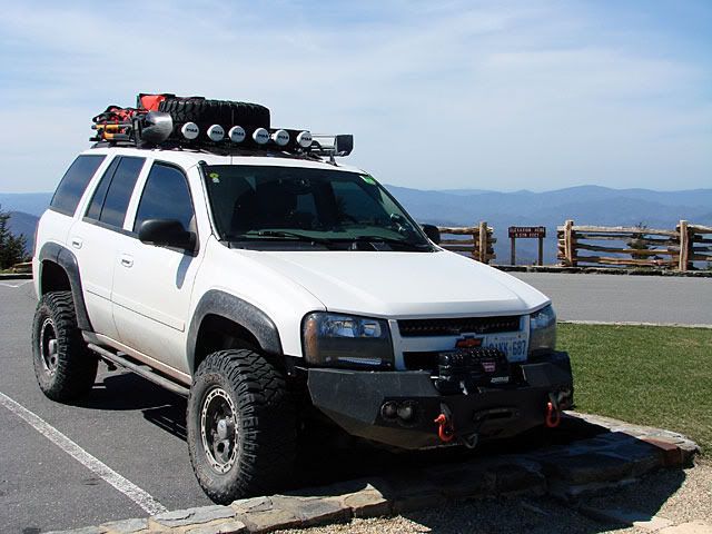
The last leg was pretty tough as the highway passes through a long flat area of farmland. It was extremely windy that day and with my roof rack, I was getting pushed all over the road. Plus I was a bit nervous trying to go over 60 mph as my Surco was really bouncing from all the wind buffeting.

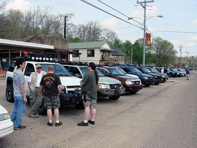
I stopped at the supermarket in Ellington for some supplies and also met up with some MORA attendees at the hotel people were staying at. A quick stop at Big Ed's for gas and some "liquid refreshment" and then it was off to the campground.

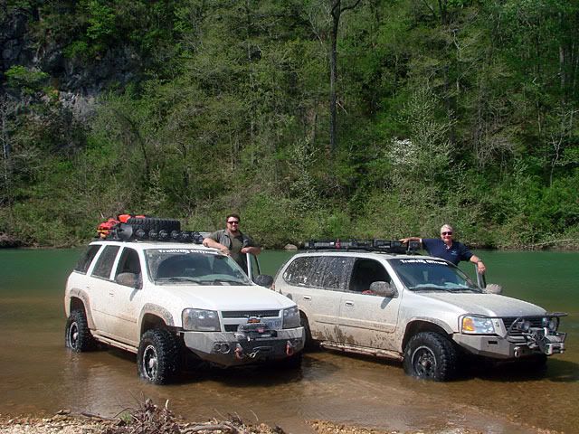
I found it no problem and set up right next to the Roadie and his traveling comfort station! We had lots to talk about that night. Later on additional MORA attendees made it out to the camp and we exchanged lots of interesting technical and travel stories.

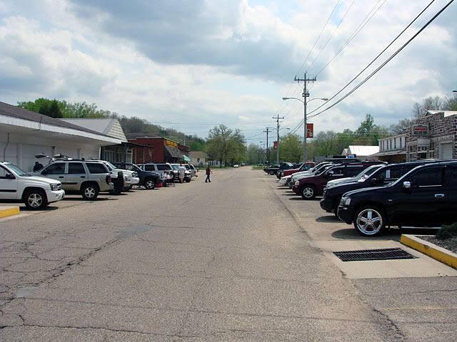
Here's some pictures of the campsite and Ellington in one of Roadie's posts.

Map References - Day 8 - Apr24

April 24 track:

* large files - 1800 x 1200

View Apr 24 track in larger window.

TECORE to MORA - Day 7 - Apr 23

Today I planned a bit of a route going north-west out of Morganton, getting into the mountains, joining the Blue Ridge Parkway, driving south to its terminus, then continuing west over the Smoky Mountains.

Map References - Day 7 - Apr23

April 23 track:

* large files - 1800 x 1200

View Apr 23 track in larger window.
My first destination was Table Rock Mountain as the (small amount of) research I did indicated it was a nice vantage point in the area. The road up was graded gravel in good condition. I would assume there are more interesting trails in the area but I just did not do enough research beforehand.

The last bit of road has been paved due to its steepness. At the end there is a parking lot, picnic area, and toilet. The views are great both to the east and west with the cliff right above the parking lot. Several groups came up with rock climbing apparatus so I assume this is a great spot if you are so inclined.

There are hiking trails that lead in all directions, including to the top of Table Rock Mountain. I did not take my hiking boots with me on this trip as I still have some tenderness in my toes from old cuts.

Here's a different angle of Table Rock after heading west to meet up with the Blue Ridge Parkway.

I have always wanted to drive along the Blue Ridge Parkway so when planning out this trip I took advantage of where I was going to be and worked it into my route.

The Parkway is beautiful as it winds its way along the Appalachian ridges. There are vistas almost every 5 minutes and stopping for each one would extend your drive tremendously, so you need to pick your spots.

My main destination on the Parkway was Mount Mitchell, the highest point in the US east of the Mississippi. Second is Mount Washington in NH but that is potentially for another expedition.

The road up to Mount Mitchell turns off the Parkway and is paved all the way to the top, where there is a parking lot, picnic areas, snack bar, and trails to the actual peak. It was early in the season so everything was closed but all the crews were out preparing, I assume for the Memorial Day weekend.

The last picture is looking west with the Smoky Mountains in the distance.

The only glitch was that the Blue Ridge Parkway was closed south of Mount Mitchell. It seems that a cliff gave way during the winter and as a result, heavy road repairs were needed, again, I assume they would want it open for Memorial Day.

Using my GPS I improvised an offroad route which which did not take me all the way back to the official detour. Again, a graded gravel road but interesting nonetheless.

Rejoining the Parkway in Azalea, I headed south again. There seemed to be many more short tunnels in this section, which also included the highest point on the Parkway itself.

Along the drive I stopped at a couple of vistas. One was a nice frame for the Trailblazer, the other was an interesting dome-like rock formation.

As I was reaching the Parkway's terminus the sun started setting. I was lucky enough to be right around Waterrock Knob which ended up providing magnificent sunset views.
The Blue Ridge Parkway ends on Hwy 441 right at the edge of Great Smoky Mountains National Park. It was dark by then so I headed west carefully along the road that would take me over the mountains and into Tennessee.

My destination was the Days Inn, Alcoa. Which is where the airport is for Knoxville. A couple of interesting things on my way down from the mountains:

  • At one point the road did a complete 360 degree turn where the ending of the turn was in a tunnel underneath the beginning of the turn - I guess its an alternative to 3 or 4 switchbacks. Here's the loop in Google StreetView.

  • As I passed through Gatlinburg Tennessee, I put my GPS unit to the test as the main street was completely closed for a ribfest and I had to get around that

TECORE to MORA - Day 6 - Apr 22

Today I planned to start heading west towards Missouri for the next weekend's MORA (Midwest Offroad Adventure) event. The weather remained great although a bit unstable as some thunderstorms were moving through the area all morning.

There was definitely more to check out at the Outer Banks and its a place I would like to come back to and stay longer:

  • Kitty Hawk
  • Wright Brothers Memorial
  • Sand dunes at Jockeys Ridge Stage Park
  • Some fishing from the beaches
  • Ocracoke Island and the ferry back to the mainland
  • Some camping in the more remote areas

After grabbing some fresh-cooked crab cakes at an oceanside seafood stand, I headed over the Washington Baum and Virginia Dare Memorial bridges to get back to the mainland. Once there, Hwy 64 follows the Alligator River/Canal for a while.

Map References - Day 6 - Apr22

April 22 track:

* large files - 1800 x 1200

View Apr 22 track in larger window.
My destination that night was the Days Inn in Morganton, NC which is at the foothills of the Appalachians.

TECORE to MORA - Day 5 - Apr 21 - Back

I headed back north with some notes handy that I took back at the hotel as to where the beaches were closed due to migratory bird nesting (Piping Plover, etc.).

Unfortunately this was the time of year that most of the beach areas that jut out into the ocean (the points) are closed. Most of the long, straight, narrow sections are open though. So I chose an access point, aired down to 20 PSI and headed for a spot with nobody around to relax a bit.

Map References - Day 5 - Apr21 - Back

April 21 Back track:

* large files - 1800 x 1200

View Apr 21 back track in larger window.
The waves were pretty big that day, and the water was COLD. I did see a few surfers at other parts of the beach, all wearing wet suits. The awning worked great again on a much windier day than back in Virginia. Really impressed with the product.

As the sun started to fall below the dune, I packed up and drove back to the access point. I aired back up to road pressure and headed north to the hotel. I did stop one more time to get a picture of the last house in Rodanthe.

Overall a great day. I would have liked to have gone to Ocracoke but unfortunately not this time. On the positive side, it gives me an excuse to come back down.

One last picture for the day. I wanted to try out my HDV Camcorder's night vision mode, so I took a picture of the hotel's court (the camcorder can take pictures to a memory card instead of taking HDV video).

TECORE to MORA - Day 5 - Apr 21 - Out

I stayed at the Colonial Inn, right in the middle of Nag's Head. Its a great little hotel nestled in right behind the beach dunes, next to the fishing pier. I woke up to beautiful weather Monday morning.

Map References - Day 5 - Apr21 - Out

April 21 Out track:

* large files - 1800 x 1200

View Apr 21 out track in larger window.
The first order of business was to get a haircut. I was so busy back home that I just didn't get around to it before I left. The very friendly staff recommended a place right across the street.

I then took some time to fill my Sceptre water containers and strap them down securely to the Surco Safari Rack.

Once that was done I headed south along Hwy 12 with my goal being Ocracoke.

However, it took me longer than expected to get to Hatteras where there is a car ferry that takes you over to Ocracoke Island. So I decided not to go over but to head back north and to take a break on the beach somewhere.

The building architecture is very interesting, I would assume all very functional to protect against hurricanes.