X88 expeditions - Documenting and sharing overland travels, adventures, and expeditions

October 28, 2009

Utah Expedition - Day 11 - Sep 14

Map References - Day 11 - Sep 14

September 14 track:

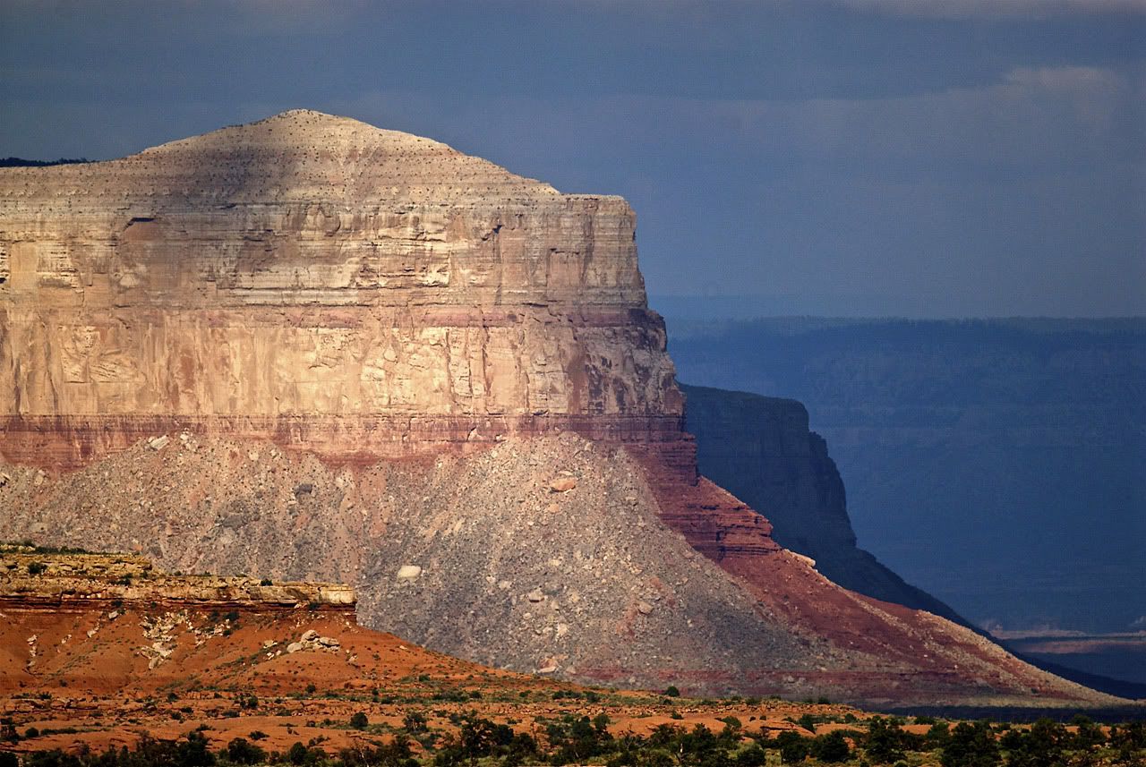
Grand Canyon NP - Tuweep Overlook:

* large files - 1800 x 1200

View Sep 14 track in larger window.
So on this day I set out to that challenging area of Grand Canyon National Park called Tuweep and the Toroweap Overlook. Here is some advice from their website:
No one should attempt the trip without ample preparation and knowledge of the hazards associated with remote desert travel. Travelers should carry extra WATER, FOOD, and GASOLINE; GOOD TIRES including at least one USABLE SPARE; and PARTS and TOOLS to handle vehicle and tire repairs.

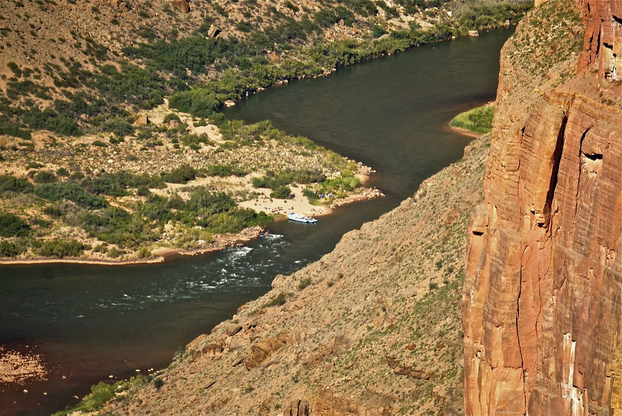
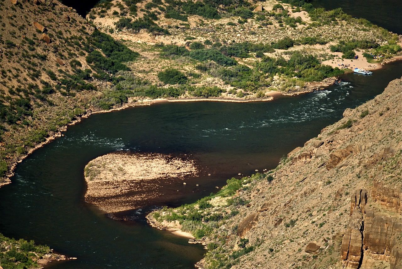
And just to underscore this warning, I found this press release on the National Parks Services site. It seems that just a week after I was at Tuweep, a hiker had an accident on the treacherous and dangerous Lava Falls Hiking route which descends 2500 feet from rim to river in a distance of just under 2 miles.

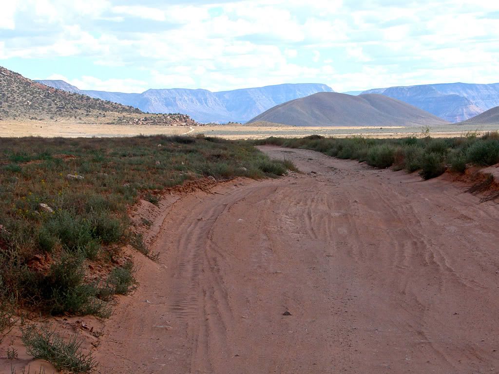
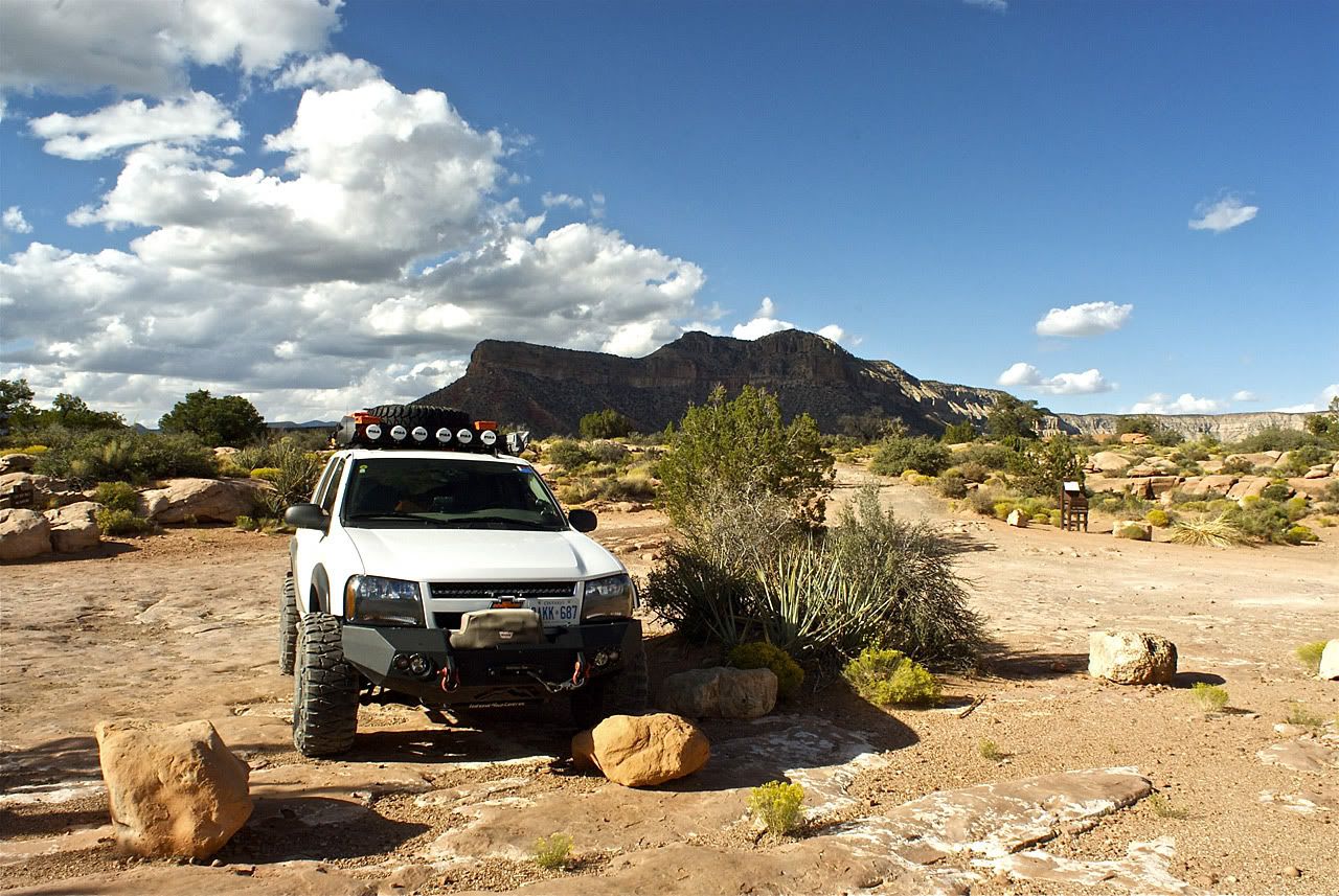
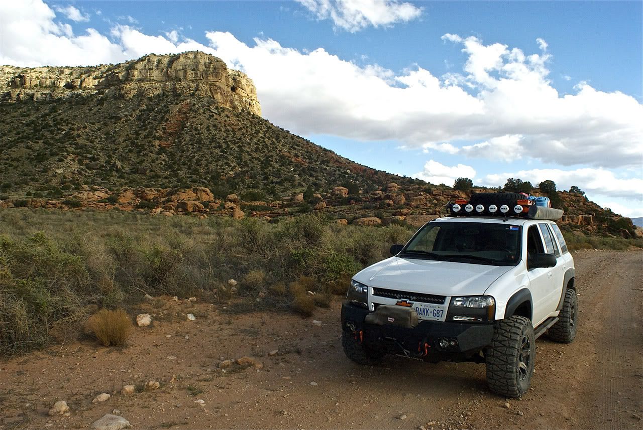
That morning I headed out to the BLM office in St. George to pick up a detailed map of this area of Arizona. I also filled my 2 Scepter gas cans, and checked the tires. My plan was to use the 90 mile Main Street Route for the trip there, and the shorter 60 mile Clayhole Route for the trip back to pavement.

The road then took me up and around Mt. Trumbull. A really nice drive with some great overlooks. I ran into a Forestry Dept. controlled burn on the slopes which was interesting.
Initially the driving was slower than I liked it as the graded gravel road was terribly washboarded. I ended up trying to drive on the softer parts of the road which was usually down the middle. At one point it looked like rain was coming in from the North which worried me a bit, many areas on this route become impassible with wet weather. Luckily, it stayed away. After a while the road got softer and clay based and I passed some abandoned homesteads.

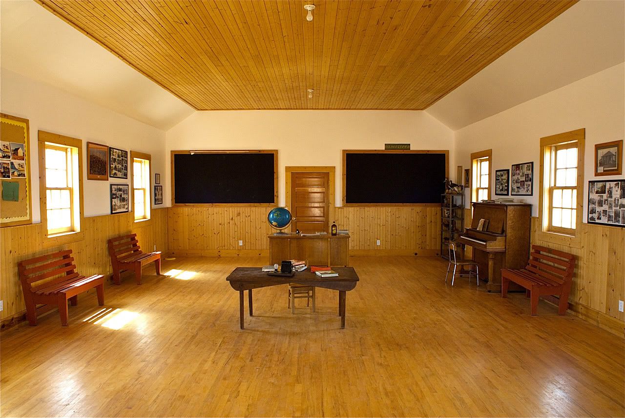
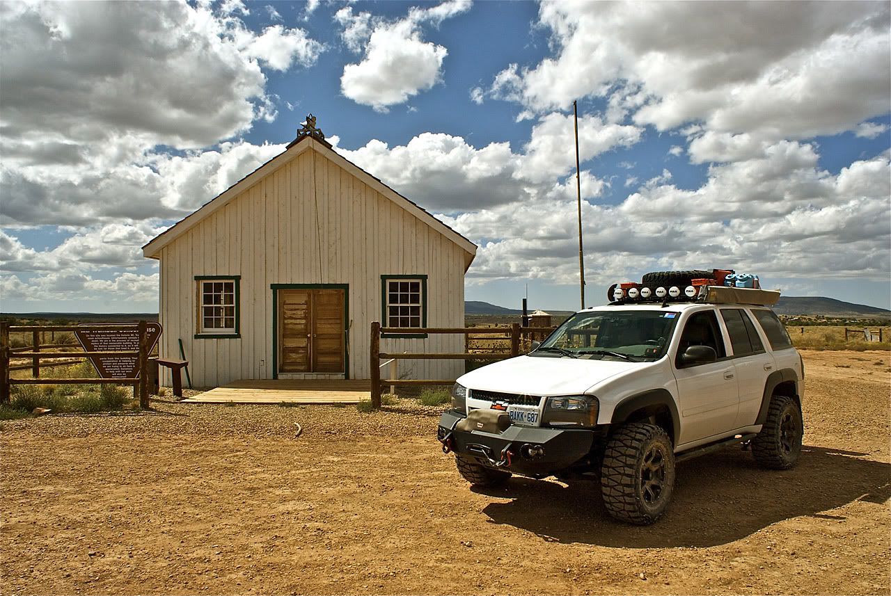
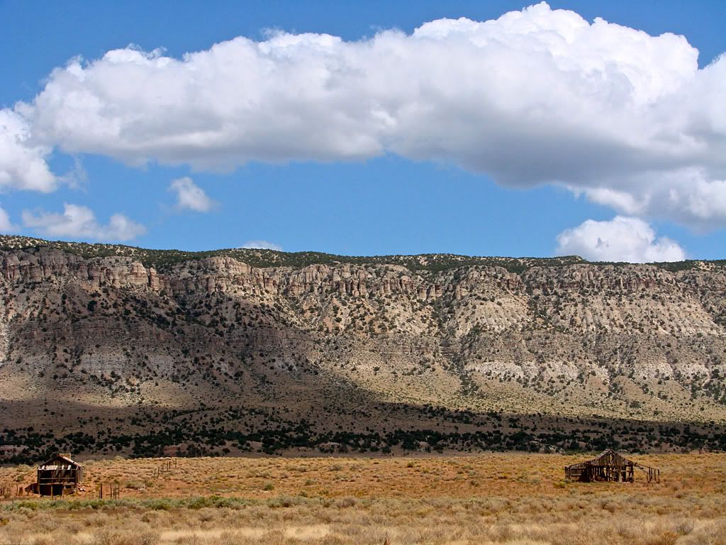
The next stop was the Mt. Trumbull Schoolhouse. It has been beautifully renovated after some asshat vandals almost burned it to the ground some years back. There was a lot of interesting information inside.

This is the day I have been waiting/planning for, but first a little background. When I was a teenager, I was lucky enough to have a cool Dad that would occasionally take me on business trips (conventions, seminars, etc.) with him to all parts of the U.S.A and Canada.

One of those early trips was to a convention in Phoenix. This was our first time out west so we combined a drive to Las Vegas with a stop at the Grand Canyon South Rim. For those of you who have been there you know that it is basically impossible to put into words.

Many years later, when I had my own business and I was headed out to Las Vegas for the CES (Consumer Electronics Show), I invited my Dad along to retrace our earlier route. However, this time I decided to check out the more remote North Rim of the Grand Canyon. At the time, I thought it was "way cool" because it was not as "touristy" as the South Rim, and you were able to walk out to areas that were much closer to the canyon walls.

Little did I know at the time that there was another access point to the Canyon, one that only offroaders or expeditionists would be interested in due to its remoteness and vehicle requirements.

There was plenty of the tall plant growing after the fire. I remember seeing a picture and write up of this plant somewhere but I cannot find it now. If anyone knows, please chime in. On the slope down there was plenty of Prickly Pear Cactus. I read that the fruit on that cactus is edible, but I'm no Survivorman so I left it alone.

After more driving you enter Grand Canyon NP with its ranger station right next to the road. There is a pit toilet and some information to read. One prominent sight warns of Sand Bogs along the road to the rim.

These are areas of very soft and deep sand. The notice asks drivers to NOT circumvent them by going off the track, but to slowly and carefully plow through them, preferably in low gear. I thought about airing down but didn't. A couple did feel quite deep but as long as I kept moving, there was no problem.
Shortly after the picture above, the terrain changes to barren rock with a few tricky climbs but nothing too radical. The exposed rock continues all the way to the Tuweep overlook parking area.
As I arrived, another vehicle was leaving so I got the place all to myself. It was windy but also eerily quiet. Once you shut the engine off you get the sense that there is no human around for thousands of miles, even though you will see that it is not the case.

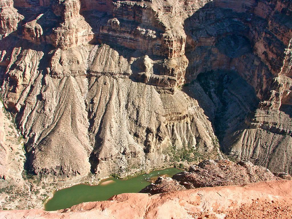
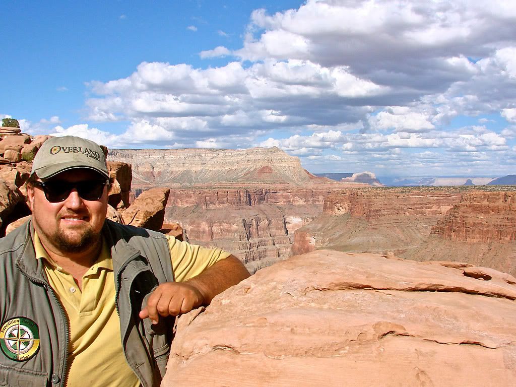
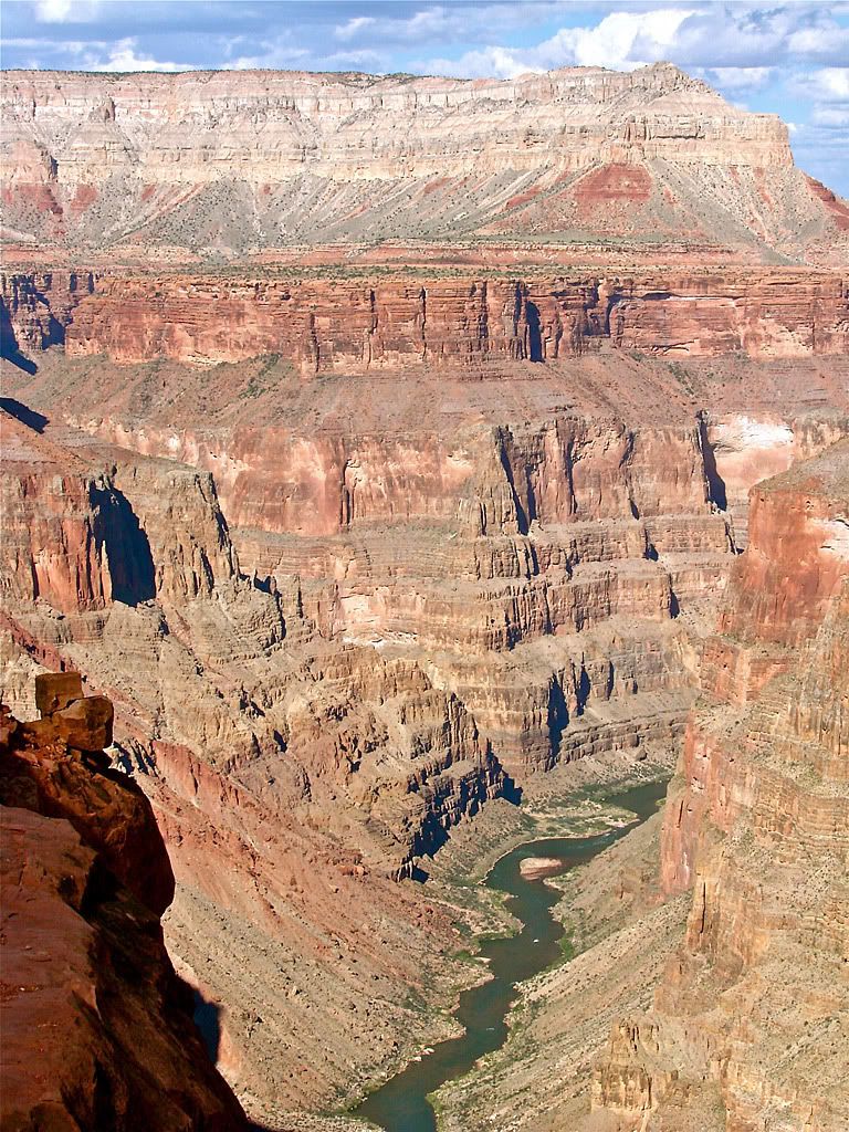
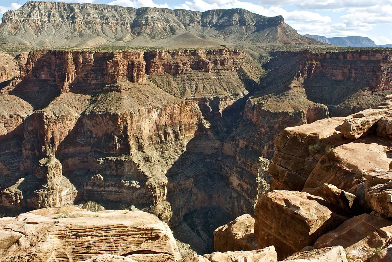
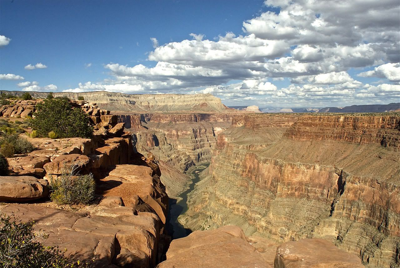
Now, I am not particularly afraid of heights, but a sheer 3000 foot drop I do respect! So here are some pictures from as close as I dared to venture to the rim. To get a picture of me with an interesting background, I wedged myself between some rocks that were pretty close to the edge.

I dicided to get out my 500mm lens to see if I could capture any wildlife. No luck there but I did get a couple of shots of a rafting trip down on the Colorado River.
As the sun was starting to get lower on the horizong I headed back north to get to pavement, the Arizona-Utah border, and ultimately to Cedar City Utah. Was it as awesome as I dreamed it would be?
Absolutely! And more! The pictures only give one sense of this narrow area of the Grand Canyon. The sounds (and quiet), the smells, driving 150 miles away from civilization, it all ads up to an unforgettable experience.

No comments: