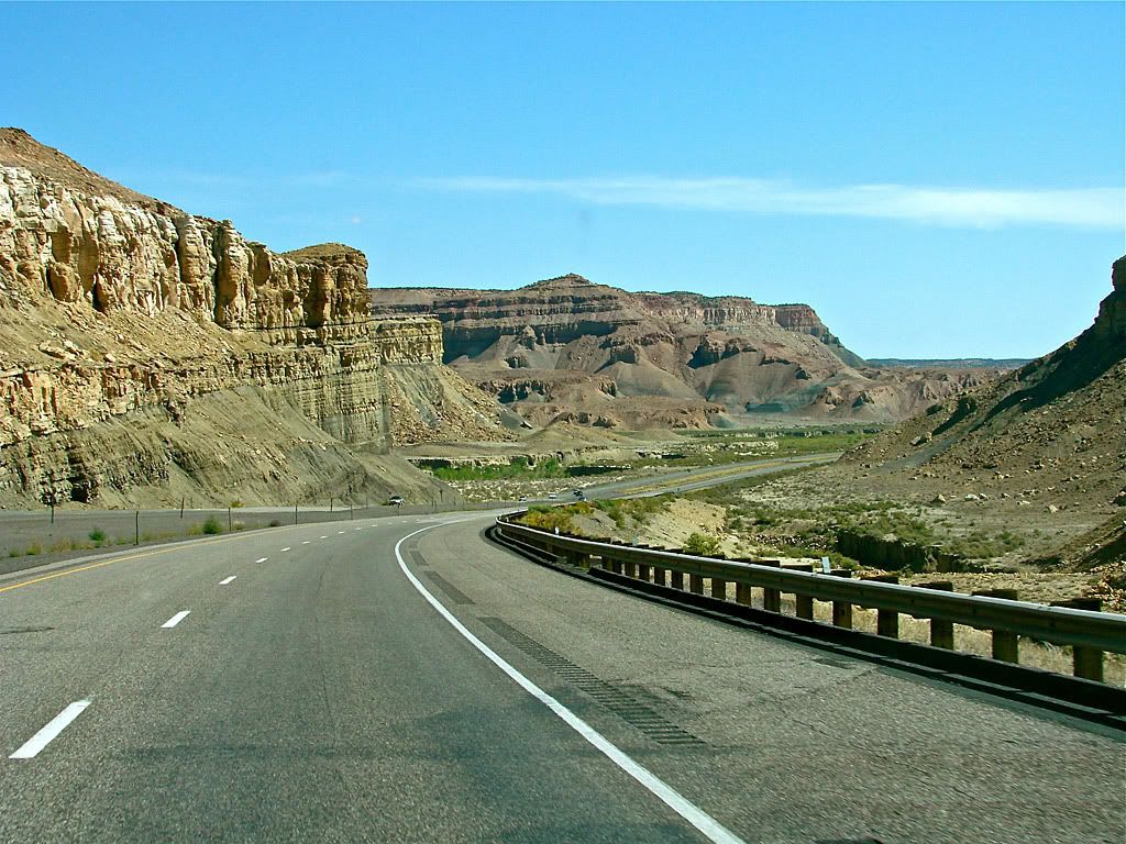
The day started off with perfect weather as I headed east on I70 through Fishlake and Manti la Sal National Forests and onto the swell. My starting point was the northern terminus of the Temple Mountain Trail (Central #12, page 466 of the book). This trail is rated a difficulty 2 with a scenic of 7, so I was really using it to get to more interesting areas.
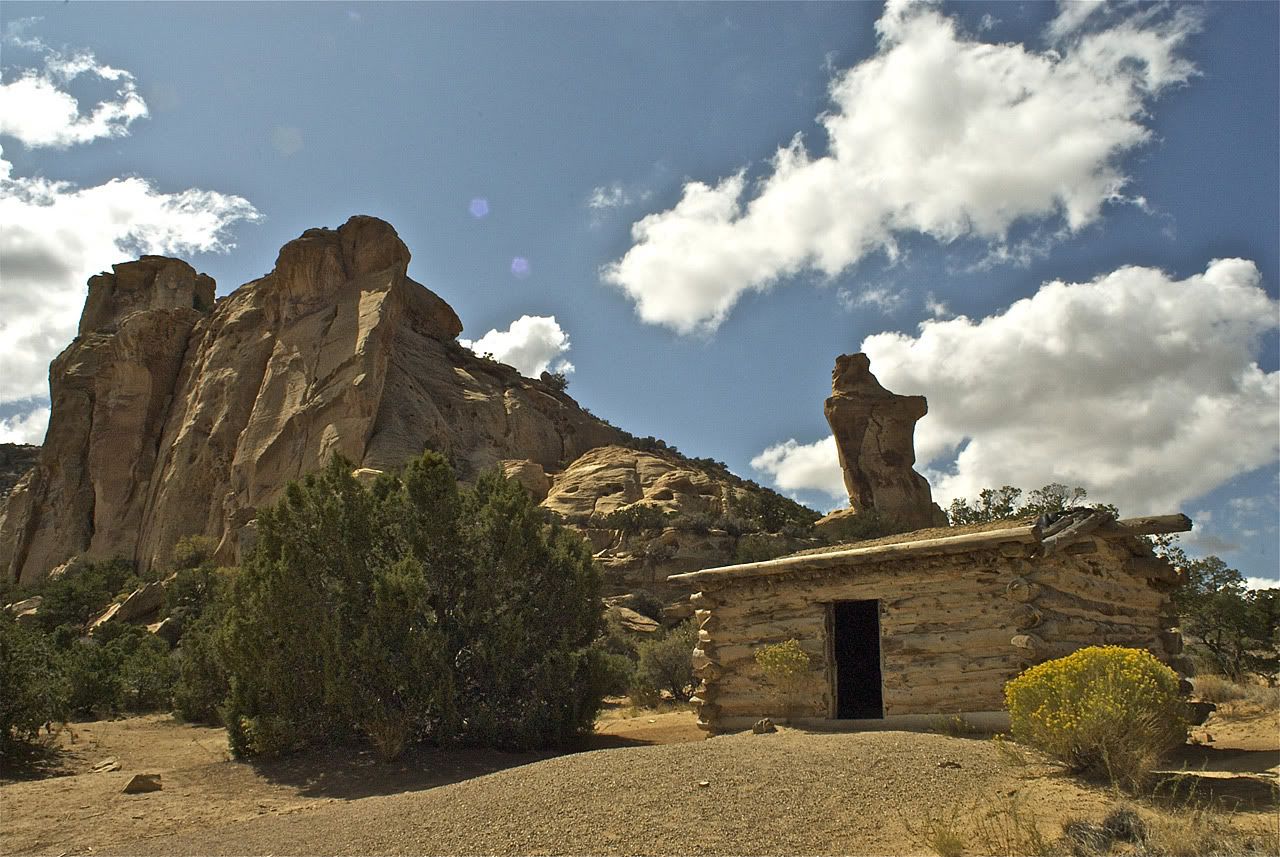
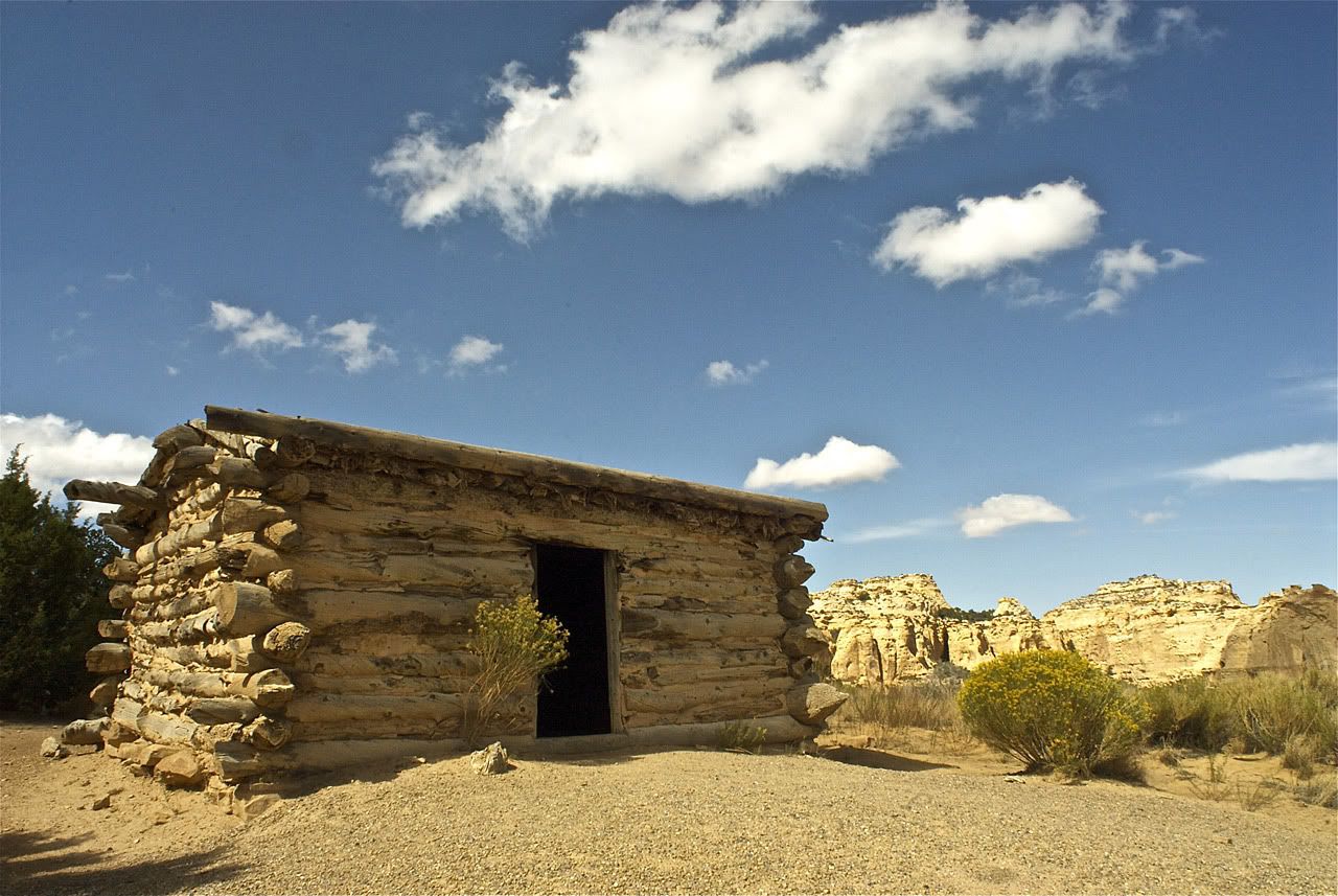
Five miles in is the turn off for Swasey's Cabin Trail (Central #13, page 468) which is a short track to what the book calls one of the oldest remaining structures in the desert as it dates back to the 1920s. It stands in front of a unique and striking rock formation. The Swasey's used a cool cave in that formation as a year-round meat locker.
I planned this day to head into the San Rafael Swell area of Utah. This area is covered in the Trails of the Central Region part of the Massey/Wilson book. I decided to explore the area south of I70 because I liked how I could tackle 4 or 5 trails with one trip. As usual, this area of Utah has an abundance of interesting areas to explore and trails to conquer. Some of the places I really would like to see but had to miss on this trip were:
- The 7 hour Cathedral Valley Trail
- Three Fingers Petroglyphs
- Black Dragon Pictographs
- Robbers Roost
- The Black Box of the San Rafael River
I then backtracked 1 mile to the fork where Rods Valley Trail (Central #14, page 470) heads south . This trail is rated a 3 because it crosses through the wash in Rods Valley several times as well as some rough rocky sections. Its a good shortcut down to the trail where I would spend most of my time this day - Reds Canyon Trail (Central #15, page 472).
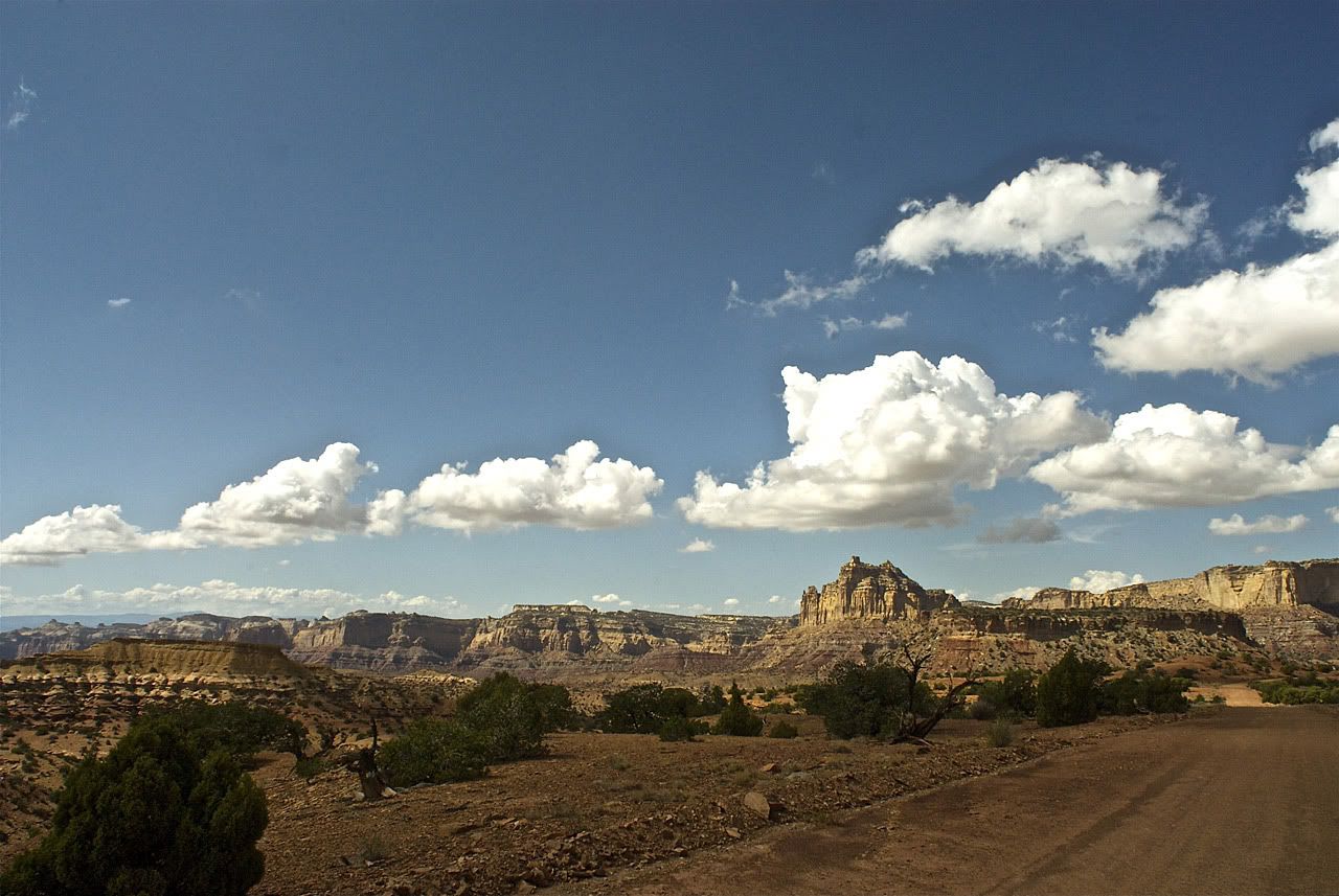
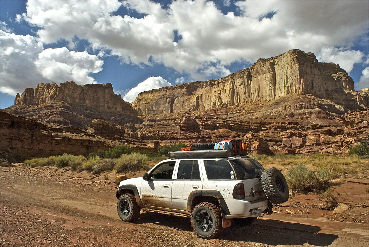
Reds Canyon is a 2.5 hour loop trail that starts up on the plateau as a graded dirt road and then drops into the canyon where it follows the wash for about 75% of the northern part of the loop. Its difficulty is rated a 3 and scenic a 10. Here is how the book describes it:
The road's rating of 3 is contingent upon the amount of erosion from recent rain and/or how long it has been since the road was last graded. If graded and dry, the road would rate a 2. However, if there have been recent washouts, the trail could be considerably more difficult, perhaps even impassable without some road repairs.
The road's rating of 3 is contingent upon the amount of erosion from recent rain and/or how long it has been since the road was last graded. If graded and dry, the road would rate a 2. However, if there have been recent washouts, the trail could be considerably more difficult, perhaps even impassable without some road repairs.
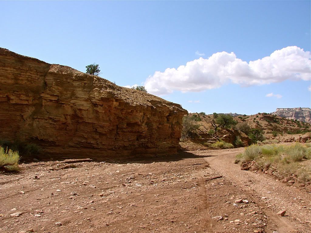
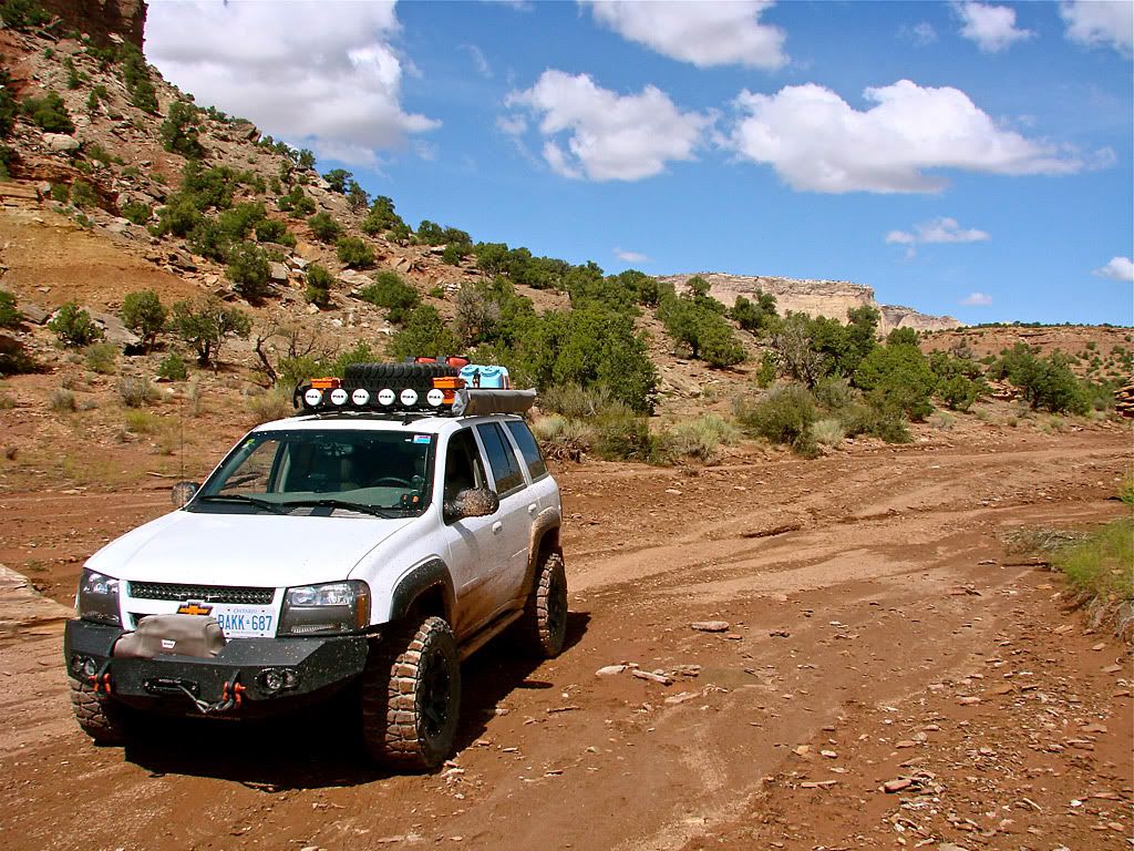
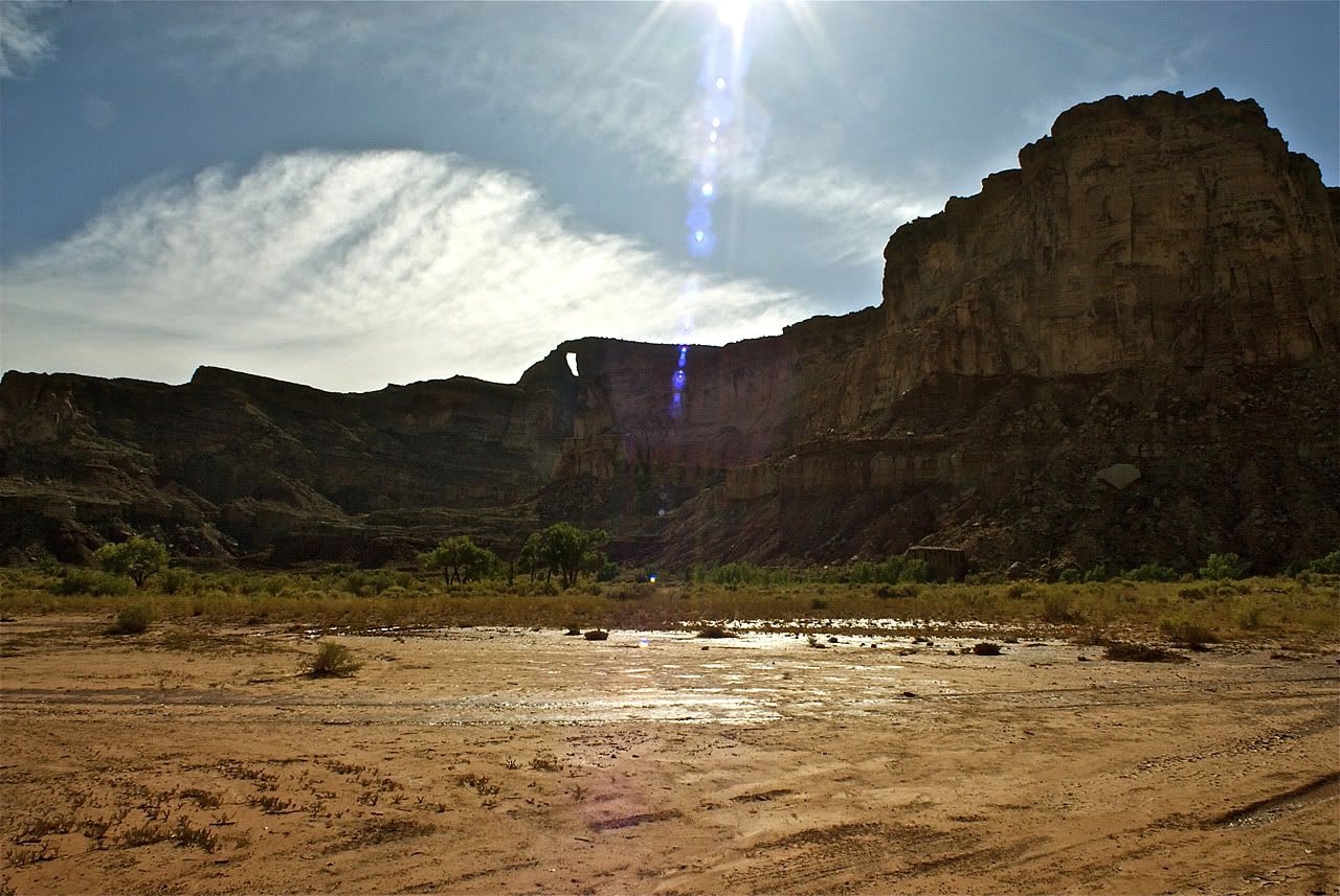
As I was there in the tail end of Utah's monsoon season, the road was about 50% washed out from a recent heavy thunderstorm. By this I mean that half the time I could tell where the road was but the other half I had no clue. Except for 1 set of tracks that I was lucky enough to be able to follow for the most part (see the third picture). Using the tracks and the road as it was displayed on my GPS, I was able to not drive astray the entire length except for 1 place, where both the person there before me (the tracks) and I ended up missing a turn-off and driving down the wash too far. I reversed in a three point turn when I noticed the tracks I was following did the same.
As for the trail, I would rate it a 5 or 6 when I was there. The recent water created several high and soft dirt mounds to get over. I think a non-lifted vehicle would have had problems on some of those. I didn't have to use my shovel anywhere but I did need to stack rocks in 2 places where the drop and climb were significant.
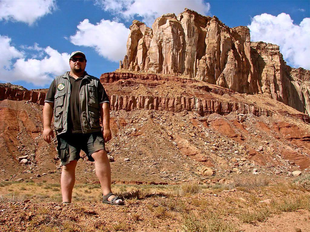
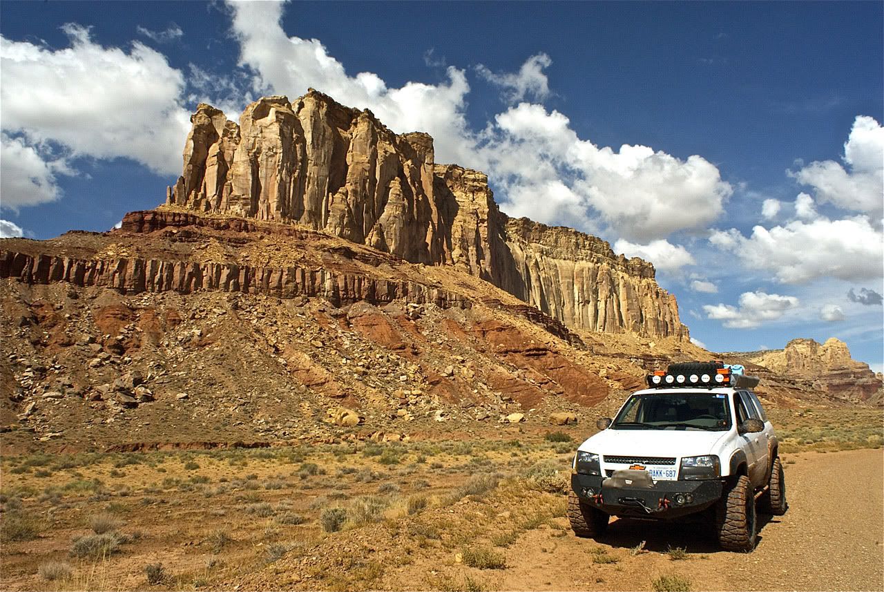
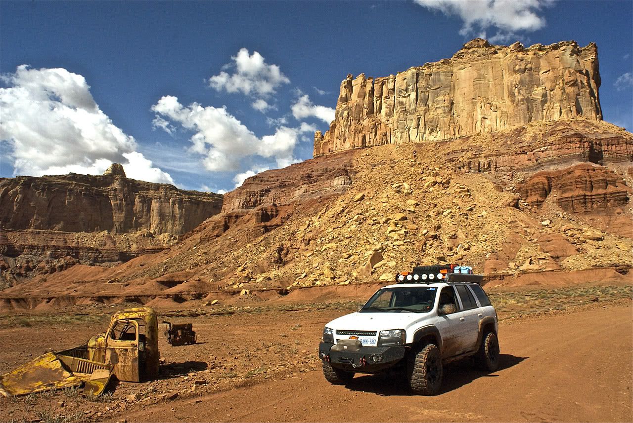
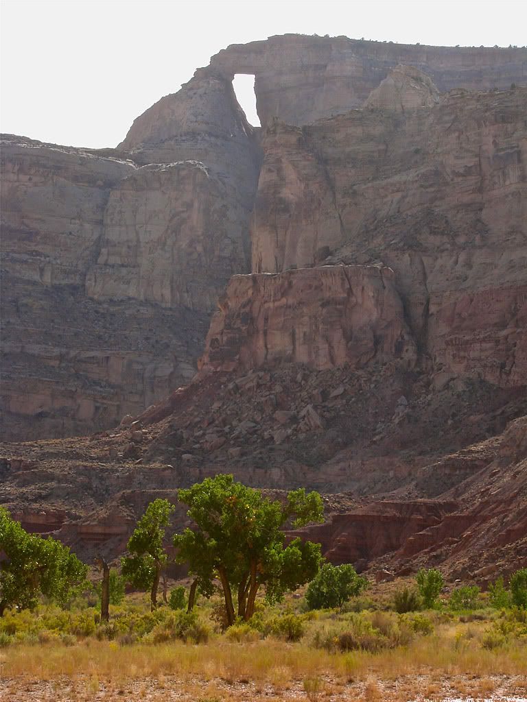
Once the trail leaves the wash for good, it heads towards Tomsich Butte which looks monolithic from a distance. Its the one in the background in the picture with the abandoned pickup cab and engine block. At the very far end of the loop, the road drops down to Muddy Creek where there is a great viewpoint for Hondoo Arch. I parked the Trailblazer here in the shade under a big Cottonwood tree and had some lunch.
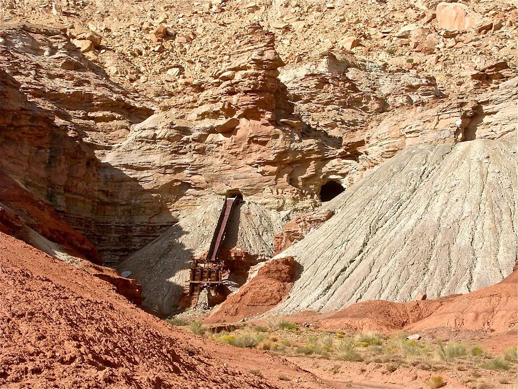
On the way back to the southern part of the loop, I took some photos of the abandoned uranium mine at the foot of Tomsich Butte. The trail then climbs up to McKay Flat and becomes a 1-rated road that takes you through rolling grassland and Sagebrush back to the Temple Mountain Trail.


No comments:
Post a Comment