The night drive north to Silverton was mostly uneventful. The road can be a bit deceiving though, if you are not careful the steep grade can speed up your vehicle and then you are in trouble. There were some emergency vehicles out after the pass (which my GPS told me was at 3330 meters) which were dealing with an overturned 18 wheeler that could not handle the sharp turn. I hope the driver was OK. Driving into Silverton this late in the season and at night was somewhat of a surreal experience. It almost looked like a ghost-town except for the 2 or 3 bars open late. After I checked in to the bed and breakfast which I reserved earlier in the day, I decided to take a stroll through town. It ended up that there were some vacancies at the more rustic places along the main street, but I didn't want to take a chance of not finding any rooms so I was staying at The Inn of the Rockies at Alma House. As I walked down a mostly deserted street I heard some great blues/jazz fusion coming from one of the bars so I popped in to take a look and grab some refreshment. The Pride of the West Restaurant and Bar was a great change of pace to all the driving I have been doing.
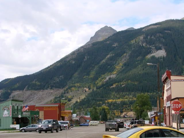
My plan for today was to head out of Silverton and combine a few trails that would ultimately get me back to pavement for my drive up to Delta tonight. Here is a picture of the 2nd main street, only the 1st main one is paved. This is where most of the tourists end up first after disembarking from the narrow-gauge railway that goes from Durango to Silverton.
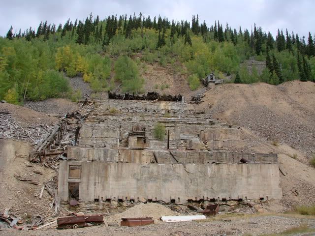
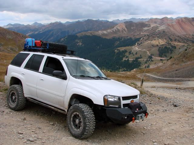
I chose the Silverton to Lake Como trail (rated 4) which takes you north out of town along Cement creek. There are various building ruins along the way. But once you get to the modern mine in operation, you take a left and the real trail starts up to Hurricane Pass and Lake Como.
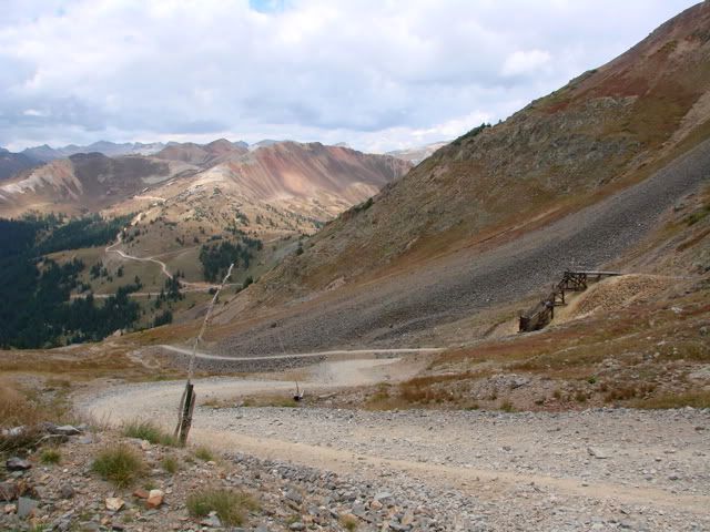
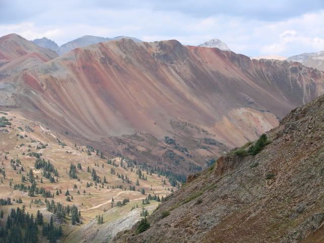
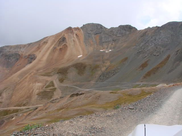
The trail you see coming out of the Red Mountain Peaks is Corkscrew Gulch Trail which leads back to the Million Dollar Hwy.
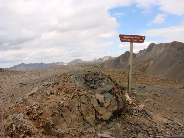
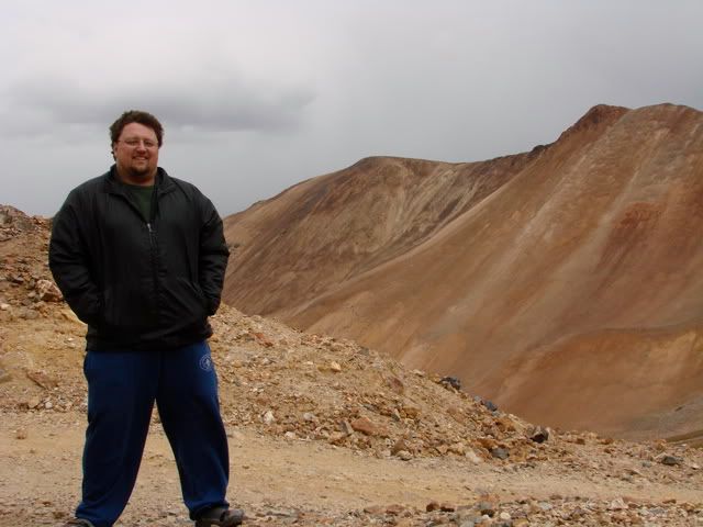
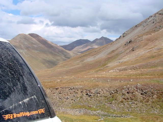
As you can probably tell, the weather was not the best as the winds picked up and the clouds started to come in. I had to finally put on some track pants and a windbreaker (first time other than that cold night camping). At least the rain stayed away. Here's Hurricane Pass at 12,407 feet.
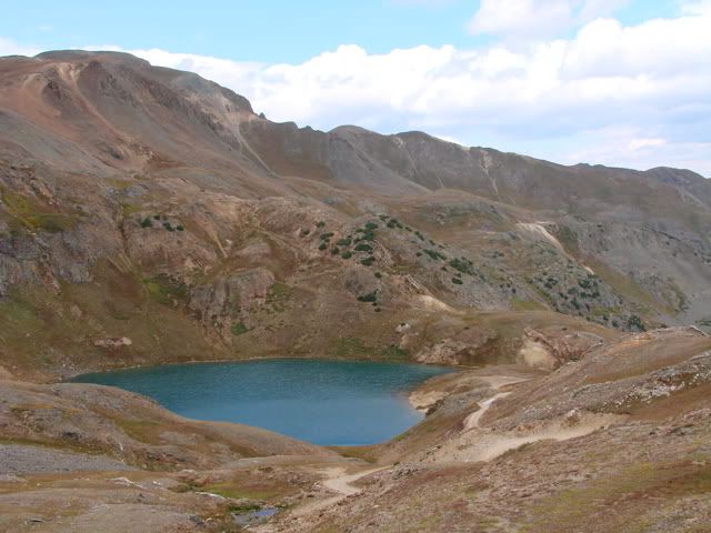
Just after you crest the pass, there is a short shelf road down to a 3-way intersection and a nice view of Lake Como. It was interesting that there was quite a bit of traffic going on here. While I was parked and taking pictures, 3 other vehicles stopped, 2 "tour jeeps" came out of Poughkeepsie Gulch (this is supposed to be a very tough trail, not even in my guide book), at least 4 motorcycles came through, and a party of 5 ATVs! A regular traffic jam.
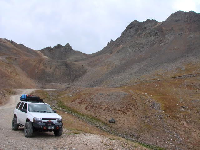
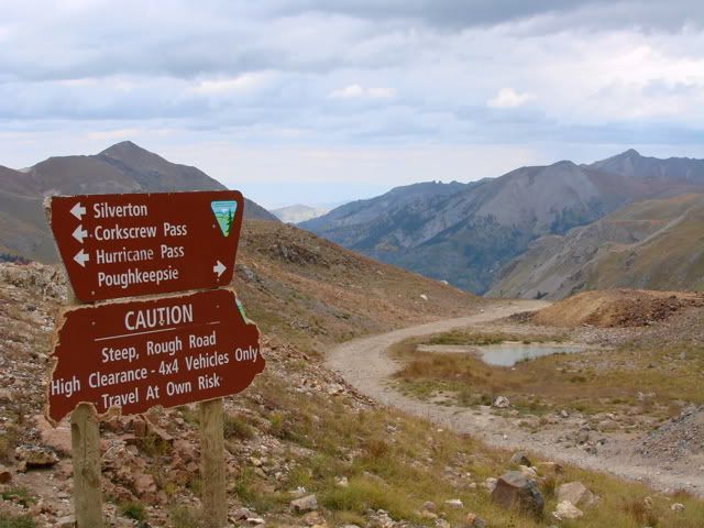
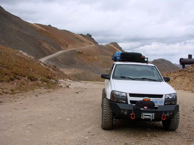
The trail I planned to continue with is not marked on the sign, its California Gulch Trail with California Pass at 12,930 feet a short distance up the mountain. I believe this will be the highest point I will reach on this trip. Just under 13,000 but I guess I will have to save that for next time! A couple of tight switch-backs forced me to reverse here and there. I probably did not need to but this kind of driving is new to me so I decided to stay on the cautious side. You can see the pass up and behind the Trailblazer. I stopped here as there was really not that much room at the pass and I didn't want to block anyone. Then the trail continues down the mountain and into the basin.
Once down into the basin, the driving is a little easier on the nerves. I stopped at a wide part in the trail and walked to the creek flowing down from the mountain. I thought about taking a drink but decided not to, still had a few hours to go and didn't want to take any chances. I sat next to that creek for about 20 minutes waiting for the clouds to clear so that I could get a shot in the sun.
Very relaxing ...
Very relaxing ...
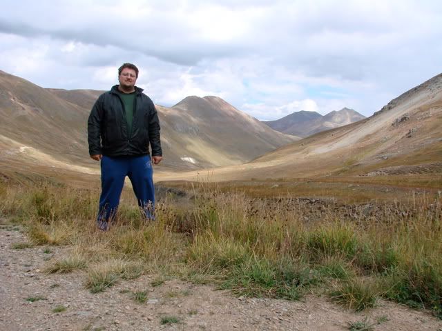
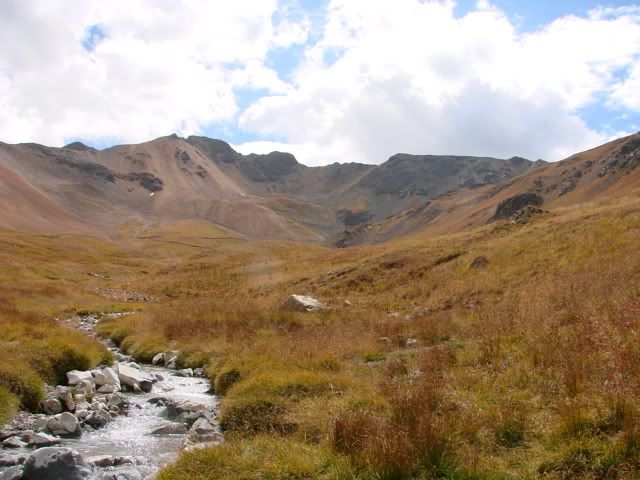
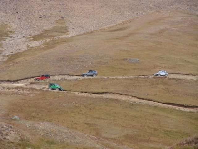
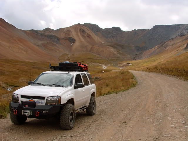
More vehicles coming through and a view down the basin.
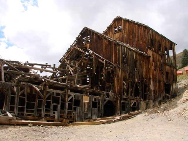
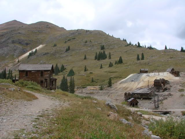
California Gulch Trail ends at the well-known ghost town of Animas Forks. Its very well preserved and there is 2WD access (in good conditions) from Silverton so there were many vehicles in the parking area.
The final leg for today was going to be the Cinnamon Pass Trail.
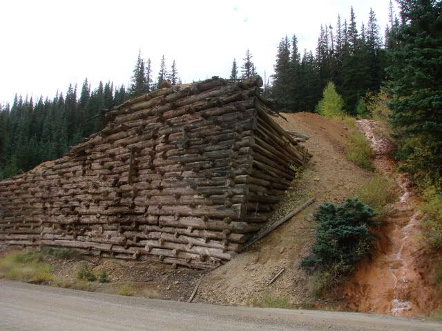
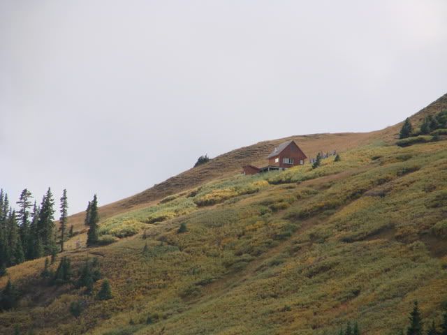
Now that's a mountain cabin!
Now that's a mountain cabin!


No comments:
Post a Comment